Ebenalp
| Ebenalp | ||
|---|---|---|
|
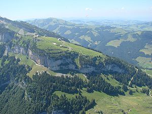
The Ebenalp seen from the air |
||
| height | 1644 m above sea level M. | |
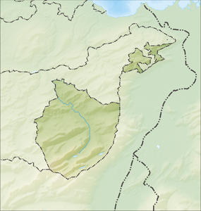
| location | Canton of Appenzell Innerrhoden , Switzerland | |
| Mountains | Alpstein , Appenzell Alps | |
| Coordinates | 749 189 / 238905 | |
|
|
||
The Ebenalp is the northern end of the Alpstein and is 1644 m above sea level. M. on a ridge that extends from the Säntis summit to the Schäfler .
reachability
One of the four Alpstein cable cars, the Wasserauen – Ebenalp cable car , leads from Wasserauen to the Ebenalp . In summer the Ebenalp is a main center for paragliders . At the same time, Ebenalp is a popular hiking destination, accessible from the Appenzell towns of Weissbad and Wasserauen, which can be reached with the Appenzell Railway .
The Säntis summit can be reached with a four-hour hike. Climbing is practiced on the rock faces below the Ebenalp (up to difficulty level 9).
In winter, modest skiing, snowboarding and snowshoeing are possible on the Ebenalp with two lifts. As in the entire Alpstein, the focus of winter sports is more on ski touring opportunities for experienced skiers.
Special
A specialty is the Bear Cave below the Ebenalp, a karst cave in limestone with the teeth and claws of cave bears exhibited in a hut at the end . A hiking trail leads through the cave, past Wildkirchli to the mountain inn Aescher , which is impressively built under a steep rockfall on the rock. Schäfler , Seealpsee , Altenalp and Bommenalp are easily accessible from there .

