Echo pass
| Echo pass | |||
|---|---|---|---|
| Compass direction | Cumberland East Bay (northwest) | Cumberland West Bay (South East) | |
| Pass height | 305 m | ||
| location | South Georgia | ||
| map | |||
|
|
|||
| Coordinates | 54 ° 17 ′ 29 ″ S , 36 ° 32 ′ 55 ″ W | ||
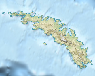
The Echo Pass is a 305 m high mountain pass on South Georgia in the South Atlantic . On the Thatcher Peninsula , it is 2.5 km southwest of Grytviken in the mountain range that extends from Mount Hodges to the southwest. The pass is part of one of the connecting routes between Grytviken and the head end of Cumberland West Bay .
The German doctor and research traveler Ludwig Kohl-Larsen (1884–1969) entered the name of the passport on a map of South Georgia created by him during the Second German Antarctic Expedition (1911–1912) under Wilhelm Filchner . The name probably goes back to the first whalers who were active in the waters around South Georgia.
Web links
- Echo pass in the Geographic Names Information System of the United States Geological Survey (English)
- Echo Pass on geographic.org (English)
