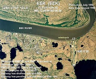
Eek River
| Eek River | ||
|
Aerial view of the Eek River at the Eek settlement |
||
| Data | ||
| Water code | US : 1401674 | |
| location | Alaska ( USA ) | |
| River system | Eek River | |
| origin | nameless lake in the Ouchklune Range 59 ° 56 ′ 12 ″ N , 160 ° 0 ′ 11 ″ W |
|
| Source height | approx. 800 m | |
| muzzle |
Kuskokwim Bay ( Bering Sea ) Coordinates: 60 ° 2 ′ 51 ″ N , 162 ° 14 ′ 18 ″ W 60 ° 2 ′ 51 ″ N , 162 ° 14 ′ 18 ″ W |
|
| Mouth height | 0 m | |
| Height difference | approx. 800 m | |
| Bottom slope | approx. 4 ‰ | |
| length | approx. 200 km | |
| Left tributaries | Middle Fork Eek River, Ugaklik River | |
| Communities | Eek | |
| Middle Fork Eek River | ||
| Water code | US : 1406294 | |
| location | Alaska ( USA ) | |
| River system | Eek River | |
| Drain over | Eek River → Bering Sea | |
| Headwaters | West flank of the Eek Mountains 60 ° 3 ′ 4 ″ N , 160 ° 29 ′ 10 ″ W |
|
| Source height | approx. 700 m | |
| muzzle | Eek River 60 ° 8 ′ 14 " N , 161 ° 34 ′ 56" W. |
|
| Mouth height | 10 m | |
| Height difference | approx. 690 m | |
| Bottom slope | approx. 6.9 ‰ | |
| length | approx. 100 km | |
The Eek River is an approx. 200 km long tributary of the Kuskokwim Bay , a bay of the Bering Sea , in southwest Alaska .
The Eek River has its origin in a small nameless mountain lake at an altitude of 800 m in the Ouchklune Range on the eastern flank of the 1423 m high Mount Oratia . The Eek River initially flows 10 km north, passing through two other lakes. Then it flows almost 10 km to the southwest. The Eek River is now turning north. It flows around the Eek Mountains along their east and north flanks. The Eek River later flows mainly in a westerly direction. It cuts through the Great Ridge and reaches the lowlands. This is crossed by the Yukon-Kuskokwim Delta . The Eek River shows a strongly meandering behavior in the lowlands . The Eek River takes on the tributaries Middle Fork Eek River and Ugaklik River from the left. He passes the village of Eek on the south bank . 4 km east of the Kuskokwim River , the Eek River joins an arm of the Kuskokwim River and flows another 20 km to the south before it flows into the sea. The Eenayarak River formerly merged with the Eek River and the Kuskokwim River arm. Today the water of the Eenayarak River flows directly into the Kuskokwim River.
The river name was first documented by Lieutenant Gavriil Andrejewitsch Sarychew in 1826.
Middle Fork Eek River
The Middle Fork Eek River is a left tributary of the Eek River. It rises on the western flank of the Eek Mountains at an altitude of 700 m . It initially flows 15 km to the west. It meets the Great Ridge , which it flows around south. It initially flows 30 km in a south-westerly direction. Then he turns sharply to the northwest. It flows through the lowlands on its last 50 km, forming numerous river loops and oxbow lakes. It finally flows into the Eek River, 25 km east of the village of Eek. The Middle Fork Eek River is approximately 100 km in length.
