Egelsee (Hofstetten)
| Egelsee | ||
|---|---|---|

|
||
| Geographical location | Landsberg am Lech district | |
| Tributaries | Groundwater | |
| Drain | drainless | |
| Data | ||
| Coordinates | 47 ° 59 '48.1 " N , 10 ° 57' 48.6" E | |
|
|
||
| Altitude above sea level | 660.3 m | |
| surface | 2 ha | |
| length | 170 m | |
| width | 200 m | |
| scope | 600 m | |
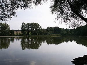
The Egelsee is a small lake with 2 hectares of water in the area of the municipality of Hofstetten in the Upper Bavarian district of Landsberg am Lech .
location
The Egelsee lies in a shallow, swampy depression that emerged from an ice age kettle . Several moraine hills rise in the immediate vicinity . To the west is the district of Hagenheim .
The lake is covered in places by water lilies and surrounded by a belt of reeds . There is a fisherman's hut on the north bank.
South of the Egelsee there are two more small kettle kettles, of which the southern one is designated as a geotope.
use
The lake is managed by a local fishing association, in the lake you can find carp , pike , pikeperch , rainbow trout , perch , roach and bream .
In summer the lake is also used for swimming.
Web links
Individual evidence
- ↑ Toteiskessel northwest of Memming (PDF) Bavarian State Office for the Environment (LfU) ,. Retrieved March 22, 2019.
- ↑ Ulrike Reschke: At the Egelsee near Hagenheim the world is still in order. Retrieved February 5, 2019 .
- ^ Stephanie Millonig: Bathing on the doorstep. Retrieved February 5, 2019 .
