Eickhoff (Nachrodt-Wiblingwerde)
|
Eickhoff
Community Iserlohn
Coordinates: 51 ° 18 ′ 44 " N , 7 ° 37 ′ 45" E
|
||
|---|---|---|
| Height : | 284 m | |
| Postal code : | 58769 | |
| Area code : | 02352 | |
|
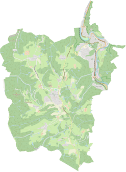
Location of Eickhoff in Nachrodt-Wiblingwerde |
||
|
Eickhoff in September 2019
|
||
Eickhoff is a district of the municipality Nachrodt-Wiblingwerde in the Märkisches Kreis in the administrative district of Arnsberg in North Rhine-Westphalia ( Germany ).
Location and description
The living space is located east of the hill village of Wiblingwerde on the Kreinberger Bach , a tributary of the Lenne .
In addition to Wiblingwerde, neighboring locations are the locations and residential areas of Eilerde , Brantenhahn , Höchst , Helbecke , Opperhusen , Stübbecken , Hallenscheid , Buchholz and Kreinberg .
history
Eickhoff emerged only in the first half of the 19th century and belonged to the school district Wiblingwerde Wiblingwerde the control community of Landbürgermeisterei Altena in county Altena . The place categorized as Kotten according to the place and distance table of the government district Arnsberg had a single residential building in 1839 and was called Eickhof . At that time, four people lived in the village, all of whom were evangelicals.
From the Prussian new admission of 1892, the place is continuously recorded on the TK25 measuring table as Eickhoff .
The municipality and estate district statistics of the province of Westphalia in 1871 list the place with one house and six inhabitants. The municipality lexicon for the province of Westphalia in 1885 gives Eickhoff a number of seven residents who lived in a house. In 1895 the place had a residential building with six residents, in 1905 one residential building and three residents are given.
On April 1, 1907, the municipalities of Wiblingwerde and Kelleramt were combined to form the municipality of Nachrodt-Wiblingwerde, which brought Eickhoff to what is now the municipality.
Individual evidence
- ↑ a b Johann Georg von Viebahn : Local and distance table of the government district Arnsberg, arranged according to the existing state division, with details of the earlier areas and offices, the parish and school districts and topographical information. Ritter, Arnsberg 1841.
- ↑ Royal Statistical Bureau Prussia (ed.): The communities and manor districts of the Prussian state and their population . The Province of Westphalia, No. IX . Berlin 1874.
- ↑ Royal Statistical Bureau (Prussia) (ed.): Community encyclopedia for the province of Westphalia, based on the materials of the census of December 1, 1885 and other official sources, (community encyclopedia for the Kingdom of Prussia, Volume X), Berlin 1887.
- ↑ Königliches Statistisches Bureau (Prussia) (Ed.): Community encyclopedia for the province of Westphalia, based on the materials of the census of December 1, 1895 and other official sources, (community encyclopedia for the Kingdom of Prussia, Volume X), Berlin 1897.
- ↑ Königliches Statistisches Bureau (Prussia) (Ed.): Community encyclopedia for the province of Westphalia, based on the materials of the census of December 1, 1905 and other official sources, (community encyclopedia for the Kingdom of Prussia, Volume X), Berlin 1909.


