Eira (river)
| Eira | ||
| Data | ||
| Water code | NO : 104 | |
| location | Molde in Møre og Romsdal ( Norway ) | |
| River system | Eira | |
| source |
Eikesdalsvatnet 62 ° 37 ′ 53 ″ N , 8 ° 6 ′ 5 ″ E |
|
| Source height | 22 moh. | |
| muzzle | in the Eresfjord coordinates: 62 ° 41 '6 " N , 8 ° 7' 53" O 62 ° 41 '6 " N , 8 ° 7' 53" O |
|
| Mouth height | 0 moh. | |
| Height difference | 22 m | |
| Bottom slope | 3.1 ‰ | |
| length | 7 km | |
| Catchment area | 1,122.21 km² | |
| Communities | Eresfjord | |
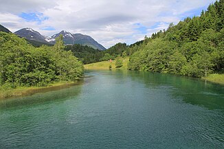
The Eira is a river in Norwegian Fylke Møre og Romsdal .
The Eira flows from Lake Eikesdalsvatnet over a distance of 7 km north to the Eresfjord , a branch of the Langfjord . The Eira forms the lower reaches of an 87 km long river system that drains an area of 1,122.21 km².
With the expansion of hydropower in the Eira catchment area and the damming of the Aursjøen at the source river Aura , a large part of the water is diverted to the Aura power station in Sunndalsøra and to the Grytten power station near Åndalsnes .
Earlier, when the mean discharge at the mouth of the Eira was 39 m³ / s, salmon were still abundant in the river.

