Ensenada Ramos
| Ensenada Ramos | ||
|---|---|---|
|
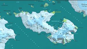
Map of Greenwich Island with the "Ramos Cove" in Discovery Bay |
||
| Waters | Discovery Bay | |
| Land mass | Greenwich Island , South Shetland Islands | |
| Geographical location | 62 ° 30 '18 " S , 59 ° 43' 44" W | |
|
|
||
The Ensenada Ramos ( Spanish ; English unofficially Ramos Cove ) is a side bay of the Discovery Bay of Greenwich Island in the archipelago of the South Shetland Islands . It is located between the headlands of Fierro Point and Correa Point in the southern part of the bay.
Scientists of the 1st Chilean Antarctic Expedition (1946–1947) named it after a signal guest who was part of the crew on the Iquique on this research trip .
Web links
- Ramos, Ensenada in the Composite Gazetteer of Antarctica (English and Spanish)

