Erica (Victoria)
| Erica | |||||||
|---|---|---|---|---|---|---|---|
 The small town of Erica |
|||||||
|
|||||||
|
|||||||
|
|||||||
|
|||||||
|
|
|||||||
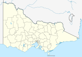
Erica is a small town in the Australian state of Victoria on the road to Rawson in Baw Baw Shire .
The area was commonly known as the Upper Moondarra in the early 20th century . The settlement of Erica grew after the construction of the railway line from Moe to Walhalla , which ran through this area. At the site of today's Erica, a station with the name Harris was opened in 1910 , but was renamed Erica in 1914 after a mountain nearby . On July 14, 1910, the first post office was opened under the name Upper Moondarra and in 1914 also renamed Erica.
The settlement of Erica lived mainly from forestry and agriculture and became the largest town on the Moe - Walhalla railway line after the decline of Walhalla in the 1920s. In 1944 the Erica - Walhalla line was closed, only occasional freight transports to Platina station took place. 1954 also closed the line to Moe.
Today Erica still has ties to the timber industry and agricultural goods processing. In addition, the city serves as a stopover for tourists who want to visit the Thomson Dam , the Walhalla Goldfields Railway , Mount Baw Baw or Mount Saint Gwinear .
In the 2016 census, there were 191 inhabitants in Erica and its surroundings. The newer town of Rawson is about 3 miles north.
Web links
Individual evidence
- ↑ a b Australian Bureau of Statistics : Erica ( English ) In: 2016 Census QuickStats . June 27, 2017. Retrieved April 18, 2020.
- ^ Post Office List . Premier Postal History.
