Eroica Peninsula
| Eroica Peninsula | ||
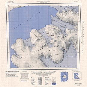
 Topographic map sheet (1: 250,000) with the Eroica peninsula (top right) |
||
| Geographical location | ||
|
|
||
| Coordinates | 71 ° 11 ′ 0 ″ S , 72 ° 30 ′ 0 ″ W | |
| location | Alexander I Island , West Antarctica | |
| Waters 1 | Mendelssohn Inlet | |
| Waters 2 | Wilkins Ice Shelf | |
The Eroica Peninsula is an icy peninsula in the west of Alexander I Island, west of the Antarctic Peninsula . It is located north of the Beethoven Peninsula between the Mendelssohn Inlet and the Wilkins Ice Shelf . In the west it runs out at Kosar Point .
It was mapped using aerial photographs and Trimetrogon survey data from the US Ronne Antarctic Research Expedition (1947–1948) and based on surveys by the Falkland Islands Dependencies Survey from 1948 to 1950. The UK Antarctic Place-Names Committee named it on February 20, 1974 based on Beethoven's 3rd Symphony with the title Eroica .
Web links
- Eroica Peninsula in the Geographic Names Information System of the United States Geological Survey (English)
- Eroica Peninsula on geographic.org (English)
