Erratic Point
| Erratic Point | ||
| Geographical location | ||
|
|
||
| Coordinates | 53 ° 3 ' S , 73 ° 23' E | |
| location | Heard ( Heard and McDonald Islands ) | |
| Waters | South West Bay | |
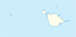
The Erratic Point ( English for boulder tip is) a small and moss-covered headland on the west side of the island Heard . It is located 2.1 km northeast of Cape Gazert near the Pageos Moraine on the shores of South West Bay .
Participants in the Gauss expedition , led by the German polar explorer Erich von Drygalski, mapped a cape from the summit of Mount Drygalski in 1902 and named it Cape Lark . In November 1929, participants in the British Australian and New Zealand Antarctic Research Expedition (1929-1931), under the direction of the Australian polar explorer Douglas Mawson, mapped a small headland in the approximate position of the cape and named it after the large number of erratic boulders they encountered there met. Scientists in a campaign by the Australian National Antarctic Research Expeditions were unable to identify the cape mapped by the German expedition in 1948, so the designation made by the Australians was retained.
Web links
- Erratic Point in the Geographic Names Information System of the United States Geological Survey (English)
- Erratic Point on geographic.org
