Eaters
|
Eaters
Spots Diepenau
Coordinates: 52 ° 27 ′ 25 ″ N , 8 ° 45 ′ 20 ″ E
|
|
|---|---|
| Height : | 70 m above sea level NHN |
| Incorporation : | March 1, 1974 |
| Postal code : | 31603 |
| Area code : | 05777 |
|
Joint municipality Uchte
|
|
|
Post mill from Essern , which was rebuilt in the museum village of Cloppenburg . According to the inscription, it was probably built in 1638.
|
|
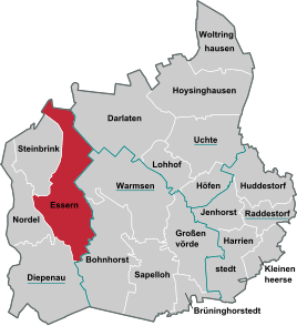
Eaters is a district of the borough Diepenau in the joint community lamp in Lower Saxony Nienburg / Weser .
geography
location
Essern is located in the southwest corner of the Nienburg / Weser district. The border with the state of North Rhine-Westphalia is 3 km to the west.
To the northeast, 2 km away, is the Great Moor (also called Uchter Moor or Great Uchter Moor ), a 3,263 hectare high moor area that has been under nature protection since 2007 .
history
On March 1, 1974, Essern was incorporated into Diepenau.
The "Heidepark" was built in 1906 in the south-western area of the village.
Events
On the last weekend in July, the traditional shooting festival held by the shooting club takes place in Heidepark. In addition, the amateur theater group Essern puts on a Low German play every January and February.
Infrastructure
Essern's greatest attraction is the “Gate to the Moor”, one of three “moor-specific information centers” (choice of words from “Tourist Information Dümmerland”) in the Diepholzer Moorniederung , where the moor railway into the Great Moor begins.
The Martinskirche in Essern serves Protestant-Lutheran Christians in the parish of Essern- Steinbrink - Nordel as a place of worship. The only educational institution in Essern is the public kindergarten "Zwergenburg".
traffic
Essern is served by the lines 74 and 75 of the Verkehrsgesellschaft Landkreis Nienburg . State road 343 leads through the village from Wagenfeld to Diepenau.
Individual evidence
- ^ Federal Statistical Office (ed.): Historical municipality directory for the Federal Republic of Germany. Name, border and key number changes in municipalities, counties and administrative districts from May 27, 1970 to December 31, 1982 . W. Kohlhammer, Stuttgart / Mainz 1983, ISBN 3-17-003263-1 , p. 199 .
- ↑ Tourist Information Dümmerland: Gate to the moor in Essern / Uchte. On the trail of "Moora - The girl from the Uchter Moor"


