Fatukoan (Holpilat)
| Fatukoan | ||
|---|---|---|
|
|
||
| Coordinates | 9 ° 21 ′ S , 125 ° 12 ′ E | |
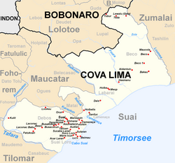
 Fatukoan on a map of Suai (before 2015) Fatukoan on a map of Suai (before 2015)
|
||
| Basic data | ||
| Country | East Timor | |
| Cova Lima | ||
| Administrative office | Maucatar | |
| ISO 3166-2 | TL-CO | |
| Suco | Holpilat | |
| height | 111 m | |
Fatukoan is an East Timorese village in Suco Holpilat ( Maucatar administrative office , Cova Lima municipality ). Until 2015 Fatukaon was still part of the Sucos Debos (Suai administrative office). Fatukoan is located at 111 m above sea level , north of the Tafara River on the southern coast road of East Timor, which runs a little further inland here.
Individual evidence
- ^ Ministry of State Administration and Territorial Management : Map of the Maucatar Administrative Office .
- ↑ a b Timor-Leste GIS Portal ( Memento from June 30, 2007 in the Internet Archive )
- ↑ Fallingrain.com: Directory of Cities, Towns, and Regions in East Timor
