
Maucatar
| Administrative office of Maucatar | |||
|
|||
| Administrative headquarters | Ogues | ||
| surface | 138.68 km² | ||
| population | 8,895 (2015) | ||
| Sucos | Population (2015) | ||
| Belecasac | 2,368 | ||
| Holpilat | 1,597 | ||
| Matai | 3,013 | ||
| Ogues | 1.917 | ||
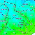
| Overview map | |||

|
|||

|
|||

Maucatar ( Maukatar ) is an East Timorese administrative office ( Portuguese Posto Administrativo ) in the municipality of Cova Lima . The main town is Ogues .
geography

Until 2014, the administrative offices were still referred to as sub-districts . Before the 2015 territorial reform, Maucatar had an area of 114.56 km². Now there are 138.68 km².
The administrative office is located in the northern center of Cova Lima. To the south and east is the Suai administrative office and to the west the Fohorem and Fatululic administrative offices . In the north is the municipality of Bobonaro with its administrative office Lolotoe . In the northwest, Maucatar borders the Indonesian West Timor .
Maucatar is divided into four sucos : Belecasac , Holpilat , Matai and Ogues .
- Climate data
Annual rainfall (2000)

Average annual temperature (2000)


Residents
8,895 people live in the administrative office (2015), of which 4,497 are men and 4,398 are women. The population density is 64.1 inhabitants / km². The largest language group are the speakers of the national language Bunak . Only in Matai does the majority speak Tetum . The average age is 18.8 years (2010, 2004: 17.2 years).
history
Maucatar was one of the small Timorese empires ruled by a Liurai . According to oral tradition, it was subordinate to the kingdom of Fohorem and paid tribute. After the Treaty of Lisbon of 1859, Maucatar was officially under Dutch sovereignty. The boundaries of the enclave were based on the boundaries of the local Bunak empires. Today the area belongs to the Sucos Holpilat , Taroman , Fatululic , Dato Tolu and Lactos . All around were Timorese empires that were assigned to Portugal. Only the empire of Lakmaras formed a connection between Maucatar and the rest of the Netherlands from the north.
In 1897 a war broke out between Lakmaras and the kingdom of Lamaquitos , which was on the Portuguese side in Bobonaro. Colonial troops were also involved in the fighting. Lakmaras finally fell under the supremacy of Lamaquitos and thus under Portuguese suzerainty. Maucatar was now an exclave and should now fall to Portugal after the contract. On the other hand, the realm of Tahakay , north of Fatululic, had meanwhile fallen to the realm of Lamaknen . Tahakay previously belonged to the Portuguese sphere of influence, Lamaknen to the Dutch. Portugal resisted this loss in the negotiations of 1902 and therefore now demanded the entire Dutch territory in central Timor. A compromise was reached with the The Hague Convention of October 1, 1904. Portugal was to receive Maucatar in exchange for the Portuguese enclave Noimuti in West Timor and the border areas of Tahakay, Tamira Ailala (east of Fatumean) and Lamaknen. Portugal ratified the treaty until 1909, but then there was a dispute over the demarcation of the border on the eastern border of Oe-Cusse Ambeno . The exchange of territory was delayed. In 1910 the Netherlands took advantage of the confusing situation after the fall of the Portuguese monarchy to reappropriate Lakmaras with European and Javanese troops. In February 1911, Portugal tried to occupy Maucatar following the 1904 Convention. However, in June it was faced with a superior Dutch force made up of Ambrose infantry, supported by European soldiers. On June 11th, the Portuguese occupied Lakmaras territory, but on July 18th, Dutch and Javanese troops also invaded the area.

In October 1911 the Manufahi rebellion broke out , which put the Portuguese in distress. The military post in Suai was evacuated on December 8, 1911 for fear of the insurgents. On December 29th, 1,200 Timorese sought protection in Maucatar, the Netherlands, because they feared reprisals from the Portuguese. Among them were the Liurai of Camenaça and his entourage. The rebellion quickly spread throughout the region and was not finally put down by the Portuguese until April 1912. The weakening of Portugal by the rebellion made it ready for negotiations with the Dutch on defining the final border. On August 17, 1916, the treaty was signed in The Hague, which largely defined the border between East and West Timor that still exists today. On November 21st, the territories were exchanged. Among others, Lakmaras, Tahakay and Tamira Ailala fell to the Netherlands. Maucatar went to Portugal, which caused a panic there. Before the handover to the Portuguese, 5000 locals, mostly Bunak, destroyed their fields and moved to the Dutch part of Timor.
In 1976 Maucatar was a retreat for the FALINTIL , who fought against the Indonesian invaders. Here she founded a base de apoio , a resistance base that offered refuge for refugees from Suai, Lolotoe , Ermera and Ainaro . The base was later destroyed by the Indonesians. At Mount Lak Hirin ( Laquirin ), many East Timorese and Indonesians died in the fighting during the Indonesian invasion. In 1989 a memorial in the form of a cross was erected here to commemorate the victims.
In Leogore there was a post of the pro-Indonesian militia Laksaur , which was involved in the wave of violence surrounding the 1999 independence referendum in East Timor . Murders, assaults and expulsions also occurred in what was then the sub-district of Maucatar. On April 9, 1999, members of Laksaur attacked Holpilat and Nainare and burned houses. Several hundred people fled into the woods. On September 9, four people were murdered by the Indonesian military and militias in Matai .
At the beginning of 2010 there were rumors of criminal gangs terrorizing the population disguised as " ninja ". The government then launched a large-scale police operation.
politics

The administrator of the administrative office is appointed by the central government in Dili. In 2013 it was José Pina Cardoso , in 2015 it was Sebastião Guterres .
economy
50% of the households in the administrative office grow corn, 50% cassava, 46% vegetables, 47% coconuts, 12% coffee and only 3% rice.
Web links
Individual evidence
- ↑ a b c d e Direcção-Geral de Estatística : Results of the 2015 census , accessed on November 23, 2016.
- ↑ Jornal da República : Diploma Ministerial no 24/2014 de 24 de Julho - Orgânica dos Postos Administrativos ( Memento of March 4, 2016 in the Internet Archive )
- ↑ a b Direcção Nacional de Estatística: 2010 Census Wall Chart (English) ( Memento from August 12, 2011 in the Internet Archive ) (PDF; 2.5 MB)
- ↑ a b Seeds of Life
- ↑ Direcção Nacional de Estatística: Census of Population and Housing Atlas 2004 ( Memento of November 13, 2012 in the Internet Archive ) (PDF; 14 MB)
- ↑ a b Cova Lima District Development Plan 2002/2003 ( Memento of October 14, 2013 in the Internet Archive ) (English; PDF file; 2.24 MB)
- ^ A b Antoinette Schapper: Finding Bunaq: The homeland and expansion of the Bunaq in central Timor ( Memento of October 24, 2013 in the Internet Archive ), pp. 163-186, in: Andrew McWilliam, Elizabeth G. Traube: Land and Life in Timor-Leste: Ethnographic Essays , 2011
- ↑ a b c Hague Justice Portal: Island of Timor: Award - Boundaries in the Island of Timor ( page no longer available , search in web archives ) Info: The link was automatically marked as defective. Please check the link according to the instructions and then remove this notice. (English)
- ↑ Antoinette Schapper: Crossing the border: Historical and linguistic divides among the Bunaq in central Timor , pp. 7-8.
- ↑ a b c Geoffrey C. Gunn: History of Timor ( Memento of the original from March 24, 2009 in the Internet Archive ) Info: The archive link was inserted automatically and has not yet been checked. Please check the original and archive link according to the instructions and then remove this notice. (PDF file; 805 kB).
- ↑ a b "Part 3: The History of the Conflict" (PDF; 1.4 MB) from the "Chega!" Report of the CAVR (English)
- ↑ Gunn, pp. 88-89
- ↑ a b "Chapter 7.3 Forced Displacement and Famine" (PDF; 1.3 MB) from the "Chega!" Report of the CAVR (English)
- ↑ CAVR final report “Chega! Report ": East Timor 1999 Crimes against Humanity ( Memento from December 19, 2009 in the Internet Archive ) (PDF; 1.7 MB)
- ↑ Wikinews, March 24, 2010, “Ninjas” in Timor-Leste?
- ↑ Ministério da Administração Estatal: Administração Municipal ( Memento from June 1, 2016 in the Internet Archive )
- ↑ Direcção Nacional de Estatística: Suco Report Volume 4 (English) ( Memento from April 9, 2015 in the Internet Archive ) (PDF; 9.8 MB)
Coordinates: 9 ° 13 ′ S , 125 ° 14 ′ E
The administrative borders within East Timor changed in 2015. This article must therefore be checked and updated if necessary. See New Administrative Boundaries .