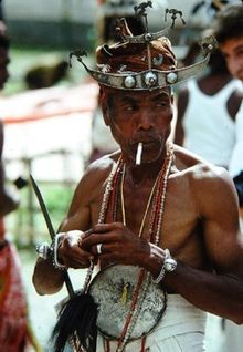
Ermera (municipality)
|
Munisípiu Ermera (tetum) Município de Ermera (port.) |
||
|
||
| Data | ||
| Capital | Gleno | |
| surface | 756.47 km² (10.) | |
| Population (2015) | 125,702 (2.) | |
| Population density | 166.17 inh / km² (2.) | |
| Number of households (2015) | 20,671 (3.) | |
| ISO 3166-2: | TL-ER | |
| Administrative offices | Residents | surface |
| Atsabe | 18,563 | 164.44 km² |
| Ermera | 36,105 | 91.47 km² |
| Hatulia | 36,778 | 275.11 km² |
| Letefoho | 22,128 | 133.30 km² |
| Railaco | 12,128 | 92.15 km² |
| map | ||
|
||
Ermera is a municipality in East Timor and the most important coffee-growing area in the country. "Ermera" means "red water" in Mambai .
geography

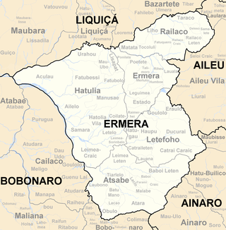
Ermera is located in the northwest of East Timor and is one of the two communities in the country without a sea coast. It borders in the north on the municipality of Liquiçá , in the northeast on Dili , in the east on Aileu , in the southeast on Ainaro and in the west on Bobonaro , whose border with Ermera is almost entirely formed by the river Lóis and its tributary Marobo .
Since the regional reform in 2015, the municipality has an area of 756.47 km² (previously 770.83 km²). Gleno has been the capital of the community since the Indonesian occupation . Further to the south-west is the capital Ermera , after which the municipality is named.
The municipality is divided into the administrative offices of Atsabe , Ermera , Hatulia (Hatólia) , Letefoho (Letefuó) and Railaco . The Sucos Poetete and Talimoro are classified as urban.
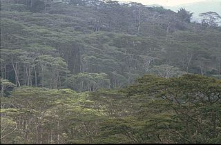
The landscape is characterized by mountains, which are crossed by some rivers. Except in the vicinity of the Lóis, the entire municipality is over 500 m above sea level. Most of them are the eastern tributaries of the Lóis, such as the Eohora in the north of the municipality. East Timor's most famous waterfall, the Bandeira, is located near Atsabe . The summit of Tatamailau is on the border with Ainaro. There is an Important Bird Area around the mountain . The Important Bird Area of Mount Fatumasin (Liquiçá municipality) extends as far as Ermera.
The majority of the community is part of the Permian or paläozänischen Aileuformation , a sequence of mudstone and maritime sandstone forms the coherent hard rock. This is typically broken and discarded . Groundwater is found locally within these fractures.
The rainy season lasts from October to May, and there is hardly any rainfall in the dry season. As a mountain region, Ermera has a milder climate than the coastal regions of East Timor. The highest administrative offices Letefoho and Atsabe are much cooler. Here the temperature in the inhabited areas can drop to 15 to 17 ° C at night during the rainy season.
Climate diagram of Gleno
Climate diagram of Hatolia Vila
Residents
125,702 inhabitants live in the municipality (2015, 2011: 122,990 inhabitants). The population density is 166.17 inhabitants per square kilometer. The average age is 17.2 years (2010). Between 1990 and 2004 the number of residents grew by 2.05% annually. In 2004 every woman in Ermera had an average of 6.10 children, the number rose to over 7.33 children in Atsabe, 8.69 in Letefoho and 9.31 in Hatulia, up to 9.89 children per woman in Railaco (national average 6, 99). The child mortality rate in 2002 in Ermera was 90 deaths per 1000 live births (1996: 118), in Railaco 108 (107), in Hatulia 110 (129), in Letefoho 119 (156) and in Atsabe 121 (164). The national average was 98. Railaco is one of 14 administrative offices in which child mortality increased contrary to the national trend.
The people in the community speak various national languages as their mother tongue . 61.3% speak Mambai (largest language group in the administrative offices of Hatulia, Letefoho and Railaco); 18.9% speak Tetum Prasa (Ermera Administration Office); 15.5% speak Kemak (Atsabe administrative office, large minority in Hatulia). If the second languages are also taken into account, in 2015 92.9% spoke Tetum, 27.5% Bahasa Indonesia, 27.8% Portuguese and 13.7% English .
In 1997 the proportion of Muslims was 2% and that of Protestants just under 2%. The proportions of these two minorities continued to decrease as part of the independence of East Timor through emigration to West Timor . In 2004 97.6% of the population were Catholics , 1.7% followers of the traditional, animist religion of Timor , 0.5% Protestants and 0.1% Muslims . The 2015 census recorded 99.23% Catholics, 0.57% Protestants, only 0.15% animists, 23 Muslims, 22 Buddhists and 14 others.
In 2015, 36.1% of residents aged three or over attended school. 20.4% had left school. 41.6% have never attended school, which is well above the national average. 4.0% of Ermera's residents only attended pre-school, more than a quarter only attended primary school. Secondary schools have completed a fifth of the population. 2.8% have a diploma or a degree; Here, too, the numbers are significantly better than the national average. The illiteracy rate in 2015 was 30.0% (women: 33.1%; men: 26.9%), the highest in the country according to Oe-Cusse Ambeno . In 2004 it was still 71.1%.
| Education | Graduation | ||||||||||
| at school | Finished school | never in a school | Preschool | primary school | Pre- secondary |
Secondary | Diploma / University of Applied Sciences |
university | No graduation | ||
| Women | 34.4% | 18.2% | 45.5% | 3.9% | 26.2% | 10.7% | 8.7% | 0.3% | 1.8% | 0.6% | |
| Men | 37.7% | 22.7% | 37.7% | 4.2% | 30.8% | 10.9% | 9.9% | 0.5% | 2.9% | 0.6% | |
| total | 36.1% | 20.4% | 41.6% | 4.0% | 28.5% | 10.8% | 9.3% | 0.4% | 2.4% | 0.6% | |
history

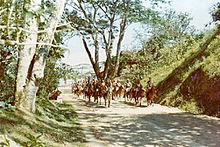

In the spring of 1867, the Kemak from Lermean (today Hatulia Administrative Office) , who were under the sovereignty of Maubara , rose . Governor Francisco Teixeira da Silva put down the resistance in an unequal battle. In the decisive battle, which lasted 48 hours, the rebels had to defend themselves against a superior force that was superior to firepower. 15 villages were captured and burned down. The number of victims among the Timorese is not known, the Portuguese put two dead and eight wounded. The territory of Lermeans was divided among the neighboring kingdoms.
The Kemak empire of Deribate was in what is now Hatulia. In 1896 over 400 people died here as a result of a punitive action by the Portuguese. The following year the year was declared dissolved, but the list of Liurais of Deribate goes back to 1937.
Atsabe was one of the centers of Timor even before the colonial era . The ruler was the Koronel messenger ( tetum Liurai ) of the Atsabe-Kemak . Atsabe used to dominate all of Kemak's inhabited areas in East Timor. In addition to the region of Atsabe, this affected areas in the north of today's Bobonaro , in the north of Ainaro and in the area of Suai . The Kemak fought against Portuguese colonization for a long time . Several Ermera empires were involved in the Cailaco rebellion against the Portuguese in the 18th century. It was not until March 1895 that Governor José Celestino da Silva launched an offensive against Obulo in order to finally subdue it for Portugal. In 1903, Letefoho's revolt against the Portuguese colonial rulers failed. 1907 could Liurai Nai-Cau independence Soros gain from Atsabe Empire. The Portuguese sovereignty was not affected.
During the Japanese occupation of Timor , the Atsabe-Kemak offered passive resistance by refusing to do forced labor or deliver food to the Japanese . Their ruler Dom Siprianu and six of his relatives were therefore executed by the Japanese. Siprianu's son Dom Guilherme Maria Gonçalves was Indonesia's governor of Timor Timur , as East Timor was called during the occupation, between 1978 and 1982 .
On May 15, 1966, there was a serious traffic accident on the road from Fatubessi to Ermera. 21 people died when they wanted to go to a bishop's mass in Ermera. A small memorial at the scene of the accident reminds of this.
In mid-1975 there was a civil war between UDT and FRETILIN as part of the decolonization process . On September 1, UDT fighters murdered at least 30 people in the Klaek Reman and Aifu massacre in Suco Poetete . When the UDT was defeated, many supporters fled across the border into Indonesian West Timor . Many East Timorese were also forcibly deported to the West and forcibly recruited as partisans or members of the Indonesian Civil Defense (Hansip) . An estimated 1,000 residents of Ermera came to Atambua in West Timor at the beginning of September 1975 and did not return to their homeland until June 1976.
After East Timor's declaration of independence on November 28, 1975, Indonesia began to occupy the neighboring country nine days later ( Operation Seroja ) after it had already invaded the border regions. By October 1976, larger towns and streets were occupied, in what was then the district the capital Ermera and the road to Aileu . In the Ermera district, bases de apoio in Fatubessi and near the Tatamailau in Catraileten were created , where the civilian population that had fled was settled by the FALINTIL resistance movement . From September 1977 the Indonesian army began destroying the bases and occupying the last resistance areas in Ermera. In Lesemau , it is believed that the Indonesian military dropped bombs containing toxins that contaminated the refugees' food and water supplies. People were dispersed or captured. Until February 1978 the district was completely under Indonesian control.
At the beginning of 1979 about a hundred men from the previous capital Ermera and the Suco Ponilala were brought by the Indonesian occupying forces to the place where the city of Gleno stands today. The Indonesian military forced the men to clear the previously uninhabited area and remove the vegetation so that the new city could be built here. If the forced laborers failed to complete their daily quota, they were tortured as a punishment. Three men who were too sick to work were killed by the soldiers. Since it was not possible to create gardens at that time, food was supplied by the military. When the work on the new capital Gleno was finished in 1983, the military stopped the supply. The families of the forced laborers have now also been forcibly relocated to Gleno. Because basic gardens had still not been laid out, deaths from starvation occurred. It was not until 1985 that the residents of Glenos were allowed to move freely.

During the Indonesian Operation Donner in the context of the independence referendum of 1999 , the pro-Indonesian militias Darah Merah , Aitarak and Pancasila operated together with the Indonesian military against supporters of East Timor’s independence in Hatulia and Ermera . The wave of violence began in April. That month, Darah Merah received modern firearms and two military vehicles from the District Command (Kodim) of the Indonesian Army. 200 Darah Merah militiamen then attacked CNRT members in what was then the Hatulia sub- district . A battle broke out in the course of which a militiaman and two CNRT members were killed. Further violence in April caused Ermera, Gleno and Atsabe residents to flee their homes. On April 10, Indonesian soldiers and Darah Merah militiamen burned down dozens of houses in the town of Ermera. Several villages were attacked in May. Four people responsible were convicted in 2004 of 14 murder, torture and rape. Most of Letefoho had to be rebuilt in the following years. Gleno also suffered badly from destruction. Following the August 30 vote, the Darah Integrasi militia and Indonesian military forcibly deported an estimated 43,000 residents of the Ermera district to Atambua. 10,000 residents fled to the mountains. Since the vehicles were insufficient, the trucks had to drive back and forth between East and West Timor several times. The houses of the deportees were set on fire. Whole villages were depopulated. Only family members of the militias and the Indonesian armed forces went voluntarily. Some villages were able to defend themselves against the threat of deportation. When the Darah Integrasi burned down 20 houses in the Aldeia Hunda (Suco Hatugau , Letefoho subdistrict) on September 9, most people sought refuge in the house of the Chefe de Aldeia.
In various parts of Ermera in the first years of independence there were repeated violent incidents in which the Colimau 2000 organization was involved. In January 2003, two villages in Atsabe sub-district were attacked and further incidents occurred in Hatulia sub-district. In November 2006, several people died in the Estado / sub-district Ermera when members of the Colimau 2000 attacked a martial arts club.
After the riots in East Timor in 2006 , the mountains of Ermera were the refuge of the Petitioners , the rebelling sections of the army . Only after the assassination attempt on the country's top politicians in 2008 , in which the rebel leader Alfredo Reinado was killed, did the last rebels finally surrender to the authorities.
In 2014, the districts across East Timor were transformed into "parishes" and the sub-districts into "administrative offices".
politics
|
District President (Bupati) |
|
| Tomás Gonçalves ( APODETI ) | May 1976-1984 |
| Lieutenant Colonel Hidayat (military) | 1984-1989 |
| Constantino Soares | 1994-1999 |
|
Administrador |
|
| Victor dos Santos | since 2001 (as of 2014) |
The administrator of Ermeras is appointed by the state government in Dili. Since 2001 this has been Victor dos Santos (as of February 2014).
In the elections for the constituent assembly in 2001, FRETILIN won the direct mandate from Ermera. However, in Ermera, actually one of its strongholds, it received only 31.94% of the vote, one of the worst results in the country. The reason for this was probably their local campaign manager Tomás Aquino Gonçalves . The former Bupati (Indonesian government president of the district) only supported the independence movement late and was extremely unpopular with the population.
In the parliamentary elections in East Timor in 2007 , the Partido Democrático (PD) was the strongest party in the district with 21.4%. The Partido Unidade Nacional (PUN) received 19.2%, the nationwide strongest party FRETILIN only 13.5% and the Congresso Nacional da Reconstrução Timorense (CNRT) 13.3%. Fernando de Araújo of the PD also won the most votes in Ermera with 45.5% in the first round of the 2007 presidential elections , but was eliminated as third nationwide. In the 2012 presidential election , the independent candidate José Ramos-Horta won the most votes in Ermera, but, like Araújo, was eliminated in third place nationwide. In the parliamentary elections in 2012 , the CNRT won the most votes in Ermera with 40.7%. FRETILIN came in second with 19.9%, while PD received just under 7%. In the 2017 presidential elections , António da Conceição of the PD in Ermera won the most votes, but only finished second nationwide. In 2017 , the CNRT won in Ermera with 34.7%, ahead of FRETILIN with 18.8%, PD with 12.9% and KHUNTO with 6.4%. In the early elections in 2018 , the Aliança para Mudança e Progresso (AMP) , to which the CNRT now belonged, received 54.2% of the vote.
Symbols
The communities of East Timor have no legal symbols. However, the Ermera profile from 2012 named the Direksaun Nacional Administrasaun Local coffee as the symbol of Ermera. Ermera is the center of the East Timorese coffee cultivation.
economy

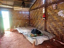
According to the 2010 census, 49% of all residents who are ten years or older work (national average: 42%). 5% are unemployed (5%). 80.5% of households practice arable farming, 86.3% cattle (as of 2010). Ermera is considered the main coffee growing region in East Timor. Many families who have some land at their disposal grow East Timor's most important export (69% of households). One of the largest coffee processing plants with wet coffee processing has been located in Estado since 2004. The owner and operator is the Cooperativa Café Timor . The future could be for the cultivation of vanilla and other spices. The climate in Letefoho and Ermera would be particularly suitable here. The cultivation of medicinal plants is also being considered.
In addition, maize (72% of households, production 2008: 1,585 t), cassava (72%, 2,313 t), sweet potatoes, vegetables (56%), bananas (all three in total 932 t), coconuts (34%) and Rice (11%, 1,371 t) is grown. The latter is mainly planted in Atsabe. In the other administrative offices it plays a lesser role. Peas, cabbage and onions have also been grown in Atsabe, and tomatoes, beans and peas in Hatulia and Letefoho. The planting of coconut palms is planned in Railaco, Hatulia and Gleno. Due to the dominant coffee cultivation, for example, food has to be imported into the Ermera administrative office. 56% of the district area cannot be used for agriculture. People keep chickens (65,229 in 71% of households) and pigs (27,501 in 68% of households) as pets. In addition, cattle (4,755 in 25% of households), goats (9,230 in 20% of households), horses (3,525 in 11% of households), water buffalo (3,728 in 7% of households) and sheep (1,229 in 2% of households ). Fish farming is planned in Hatulia, Gleno and Atsabe.
The municipality's business center is the capital, Gleno. Atsabe used to be known for the high quality of its tais , woven textiles that were also sold nationwide. At that time, trade was the most important source of income for the population in Atsabe, even before agriculture. Many of the traders fled to West Timor as a result of the 1999 riots. In 2001 it was still unclear whether they would return to Atsabe to resume business.
There are hot springs in Fatubessi and Koliati .
Radio Café Ermera (FM 92.3 MHz), the communal radio station for the municipality, broadcasts from Gleno .
Personalities
- Augusto de Araújo , MP
- Madalena Boavida , Minister of Finance
- Lucas da Costa (1952–2019), politician and university director
- Cláudio de Jesus Ximenes (* in Ermera), President of the Tribunal de Recurso de Timor-Leste
- Eduardo de Jesus Barreto (* 1951 in Ermera ), politician
- Maria Olandina Isabel Caeiro Alves (* 1956), diplomat
- Gabriel Ximenes (* 1956 in Ermera; † 2009), MP
- Mateus de Jesus (* 1959 in Atara ), MP
- Maria da Costa Exposto (* 1960 in Ermera), politician
- António 55 dos Santos (* 1960 in Poetete ), politician and independence activist
- José Neves (* 1962 in Poetete), presidential candidate and civil servant
- Sara Lobo Brites (* 1967), politician
- João Maia da Conceicão (* 1969 in Ermera), politician
- Rui Manuel Hanjam (* 1969 in Ermera), Vice Minister
- Gastão Salsinha (* 1974), soldier and deserter
- Agostinho Lay (* 1975 in Hatulia ), MP
- Elvina Sousa Carvalho (* 1986), politician
Partnerships
-
 Campo Maior , Portugal (since March 21, 2013)
Web links
- District Profile 2013 (tetum, PDF file)
supporting documents
- Ministry of State Administration and Territorial Management
- Ermera District Development Plan 2002/2003 (English; PDF file; 374 kB)
Individual evidence
- ↑ a b c d e f g h i j k l m n Direcção-Geral de Estatística : Results of the 2015 census , accessed on November 23, 2016.
- ↑ a b c d Direcção Nacional de Estatística: 2010 Census Wall Chart (English) ( Memento from August 12, 2011 in the Internet Archive ) (PDF; 2.7 MB)
- ↑ Geoffrey Hull : The placenames of East Timor , in: Placenames Australia (ANPS): Newsletter of the Australian National Placenames Survey, June 2006, pp. 6 & 7, ( Memento of the original from February 14, 2017 in the Internet Archive ) Info: The archive link was inserted automatically and has not yet been checked. Please check the original and archive link according to the instructions and then remove this notice. accessed on September 28, 2014.
- ↑ a b c d e f "Chapter 7.3 Forced Displacement and Famine" ( Memento from November 28, 2015 in the Internet Archive ) (PDF; 1.3 MB) from the "Chega!" Report of the CAVR (English)
- ↑ Asian Development Bank: TIM: District Capitals Water Supply Project - Rehabilitation of Lake Lehumo , pp. 20 ff., September 2011 , accessed on February 23, 2014.
- ↑ Direcção Nacional de Estatística: Timor-Leste in figures 2011 (PDF; 3.8 MB) ( Memento from February 19, 2014 in the Internet Archive ), accessed on May 5, 2013
- ↑ a b Census of Population and Housing Atlas 2004 ( Memento of November 13, 2012 in the Internet Archive ) (PDF; 14 MB)
- ↑ District Priority Tables: Ermera 2004 ( Memento from 20131113165448) (PDF; 14.9 MB)
- ↑ Andrey Damaledo: Divided Loyalties: Displacement, belonging and citizenship among East Timorese in West Timor , ANU press, 2018, limited preview in Google Book Search
- ↑ Carlos Filipe Ximenes Belo : Os antigos reinos de Timor-Leste (Reys de Lorosay e Reys de Lorotoba, Coronéis e Datos) , pp. 128-131, Tipografia Diocesana Baucau 2011.
- ^ Andrea K. Molnar: Died in the service of Portugal
- ↑ History of Timor - Technical University of Lisbon ( Memento of the original from March 24, 2009 in the Internet Archive ) Info: The archive link was automatically inserted and has not yet been checked. Please check the original and archive link according to the instructions and then remove this notice. (PDF; 824 kB)
- ↑ picture of the monument , accessed on June 4, 2019.
- ^ Government of East Timor: Government builds Reconciliation Monument of Aifu's massacre , April 8, 2016 , accessed June 20, 2017.
- ↑ "Chapter 7.2 Unlawful Killings and Enforced Disappearances" (PDF; 2.5 MB) from the "Chega!" Report of the CAVR (English)
- ^ Unofficial Guide to East Timor
- ↑ The Age, Report on the Jan. 2003 Atsabe Incident
- ↑ "Part 4: Regime of Occupation" (PDF; 563 kB) from the "Chega!" Report of the CAVR (English)
- ↑ World Bank: Participation List Timor-Leste and Development Partners Meeting 3-5 December 2003 , accessed April 27, 2020.
- ^ National Directory of Studies and Research. (No longer available online.) Archived from the original on June 25, 2015 ; Retrieved February 7, 2014 .
- ↑ Friends of Ermera ( Memento from February 26, 2011 in the Internet Archive )
- ↑ Descentralização Administrativa na República Democrática de Timor-Leste: Ermera , accessed on February 7, 2014
- ↑ Lurdes Silva-Carneiro de Sousa: Some Facts and Comments on the East Timor 2001 Constituent Assembly Election ( Memento of October 16, 2013 in the Internet Archive ) ( RTF ; 199 kB), Lusotopie 2001: pp. 299–311.
- ↑ Daljit Singh, Anthony L. Smith: Southeast Asian Affairs 2002 , p 60, Institute of Southeast Asian Studies., 2002
- ^ Electoral Geography
- ↑ CNE: CNE 2017
- ↑ CNE: Munisipios , accessed May 30, 2018.
- ↑ Profile of the Ermera District 2012: 2.1.3 Simbolu Distritu Ermera , p. 14.
- ↑ a b c Direcção Nacional de Estatística: Suco Report Volume 4 ( Memento from April 9, 2015 in the Internet Archive ) (English) (PDF; 9.8 MB)
- ↑ Direcção Nacional de Estatística: Timor-Leste in Figures 2008 ( Memento of 7 July 2010 in the Internet Archive ) (PDF; 3.7 MB)
- ↑ ARKTL - Asosiasaun Radio Komunidade Timor-Leste (English)
- ↑ Municípios Portugueses: Geminações de Cidades e Vilas , accessed on January 7, 2018.
Coordinates: 8 ° 43 ' S , 125 ° 26' E


