Lóis
|
Lóis Loes, Lóes |
||
|
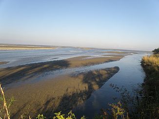
Mouth of the Lóis |
||
| Data | ||
| location | East Timor | |
| River system | Lóis | |
| origin | Mountains of Fatumean | |
| Source height | 1320 m | |
| muzzle | In the Sawusee coordinates: 8 ° 44 ′ 14 " S , 125 ° 5 ′ 33" E 8 ° 44 ′ 14 " S , 125 ° 5 ′ 33" E |
|
| Mouth height | 0 m | |
| Height difference | 1320 m | |
| Bottom slope | 17 ‰ | |
| length | 80 km | |
| Catchment area | 2191 km² | |
| Left tributaries | Nunura , Bulobo | |
| Right tributaries | Marobo , Gleno | |
| Small towns | Maliana | |
|
The Lóis system irrigates almost the entire municipality of Bobonaro. |
||
|
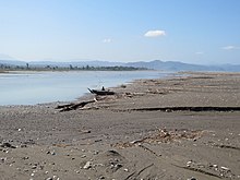
The Lóis, east of the bridge in Liquiçá |
||
The Lóis (also Loes or Lóes ) is the longest river in East Timor with its source rivers with 80 km . It has a catchment area of 2191 km².
course
The tributaries of the Lóis originate in the central highlands of Timor . The largest tributaries are the Talau ( Talaoe , Taipu ), which rises in the Indonesian West Timor , the Malibaca ( Mota Malibaca , Mota Malibaka , Rio Malibaca , Rio Male Baca , Rio Malibacu , in the upper reaches also Matihaca ), which comes from the mountains of Fatumean ( Municipality of Cova Lima ) and the Marobo , which rises near the town of Marobo .
The Malibaca flows in a north-westerly direction and forms the western border river between the municipality of Bobonaro and Indonesia until it meets the Talau, which forms the southern border river and flows from west to east. The confluence is now called Nunura ( Larodel or Nunutura , in the upper reaches also Be Bai , Beba or Bé-Bai ) and flows across the middle of Bobonaro. The Marobo forms the border between the municipalities of Ermera and Bobonaro, first flowing north and then turning east. Finally, Nunura and Marobo meet and eventually form the Lóis. The Lóis flows further east along the northern border of Bobonaro to Ermera and Liquiçá . On the north coast it flows into the Sawu Sea 20 km southwest of Maubara .
The Gleno is a major tributary after the confluence of the Nunura and Marobo rivers, which flows along part of the northern border of Ermera and has tributaries from Ermera, Liquiçá and Aileu . The Bulobo and its tributaries drain the center of Bobonaro and flow into the Nunura.
The Magapu tributary tumbles down a sheer wall and forms the Bandeira , one of the most famous waterfalls in East Timor.
More tributaries
Aideno , Utobato , Claola , Hatoleal , Lesupu , Neuculi , Lesupu , Timoreme , Timerema , Hatepoci , Malubolo , Sahalolo , Nakere , Karbau , Biusosso , Gelesu , Buloho , Gimetan , Biapolu , Matenua , Mukuki , Lale , Sasso , Biupira , Laecouken , sele , Dikasbata , Surine , Kailook , Bismaumate , Gumuloa , Dirobatelau , Manobira , Curiho , Caicabaisala , Guradi , Acolaco , Guotclua , Lendeum , Daurecco , Goumeca , office , Manolldodo , Roumetalena , Maurotieramata , Aileu , Olomasi , Manomau , Meleotegi , Tutan , Gamerama , Manusama , Bapera , Eahora (in the upper reaches of Lahosa ), Hatobwi , Fohola , Celere , Garai , Magolara , Motur , Aiboro , Biaioni , Meipu , Caraulun , Hatoe , Ladibau , Tehate , Pusulu , Ladiban , Magapu , Leteu , Slau , Coulala , Baluani .
meaning
In addition to the Northern Lacló , the Lóis is one of the few rivers that carry water all year round in the northern part of the island, as they are fed from the south. Rice can therefore be grown, especially in the areas between Malibaca, Nunura and Marobo, one of the main foodstuffs of the local population.
See also
Web links
Individual evidence
- ^ A b Asian Development Bank: TIM: District Capitals Water Supply Project - Rehabilitation of Lake Lehumo , p. 22, September 2011 , accessed on February 23, 2014.
- ↑ District maps on the Timor-Leste GIS Portal ( Memento from June 30, 2007 in the Internet Archive )
- ↑ Census of Population and Housing Atlas 2004


