Nunura
|
Nunura Larodel, Nunutura, Bebai, Bé-Bai |
||
|
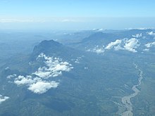
The Nunura flows through the center of Bobonaro |
||
| Data | ||
| location | East Timor | |
| River system | Lóis | |
| Drain over | Lóis → Lake Sawu → Pacific Ocean | |
| origin | Confluence of the Talau and Malibaca rivers 8 ° 57 ′ 59 ″ S , 125 ° 6 ′ 46 ″ E |
|
| muzzle | in the Lóis coordinates: 8 ° 45 ′ 47 " S , 125 ° 11 ′ 49" E 8 ° 45 ′ 47 " S , 125 ° 11 ′ 49" E
|
|
| Left tributaries | Hatleai, Meuculi, Matenua, Mukuki, Laecouken, Talau (Taipui) | |
| Right tributaries | Aideno, Utobato, Claola, Lesupu, Timoreme, Hatopoci, Timerema, Malubolo, Bulobo, Sahalolo, Nakere, Karbau, Biusosso, Gelesu, Buloho, Gimetan, Biapelu, Biupira, Sasso, Lale, Malibaca (Matihaca), Sele | |
| Small towns | Maliana | |
| Communities | Memo , Biamaraen , Marko | |
The Nunura (also Larodel , Nunutura , Bebai , Bé-Bai ) is a river on the island of Timor . "Nunura" means " banyan tree " in Kemak .
geography

Like many rivers on the island, depending on the region through which it flows, it has different names, which can often be found under different spellings. One of its source rivers rises near the West Timorese Atambua and, flowing to the east, forms the border between the Indonesian government district ( Kabupaten ) Belu and the East Timorese administrative office Balibo as Talau ( Talaoe ) .
The second source flow, the Malibaca ( Tetum : Mota Malibaca , port. : Rio Malibaca also Mota Malibaka , Rio times Baca , Rio Malibacu , in the upper reaches: Rio Mathiaca ) follows with his running almost the entire boundary between the Timorese administrative offices Maliana and lolotoe and the Indonesian West Timor. Small rivers repeatedly flow into the Malibaca, such as the Ribeira Sele (from the Suco Lebos ).
From the point where Talau (which shortly before changed its name to Taipui ; also Talade ) and Malibaca meet, the river leaves Indonesia and flows (from here partly referred to as Be Bai or Bé-Bai ) through East Timor's municipality of Bobonaro to the northeast. To the west are the administrative offices of Balibo and Atabae , to the east are Maliana and, after the tributary of the Bulobo , the administrative office of Cailaco . Finally, the Nunura flows into the Lóis at the municipal boundary , which flows further west into the Sawu Sea .
A little north of the confluence of the Malibaca and Talau rivers, East Timor's longest bridge spans the Nunura, the Nunura Bridge . After 1999 a military camp of INTERFET and the United Nations stood here . The road from the municipal capital Maliana to Balibo leads over the bridge.
economy
The Nunura is of great importance for the supply of the population because, unlike most rivers in north Timor, it carries water all year round. Rice, one of the staple foods of the region, is grown in many places along its banks.
history
On January 6, 2006, three Indonesians were shot dead by East Timorese police on the border near Turiskain on the Malibaca. According to Indonesian military sources, the three victims were fishing when fire opened on them without warning. Jakarta protested violently. Following the incident, East Timorese women were raped.
Individual evidence
- ↑ Geoffrey Hull : The placenames of East Timor , in: Placenames Australia (ANPS): Newsletter of the Australian National Placenames Survey, June 2006, pp. 6 & 7, ( Memento of the original from February 14, 2017 in the Internet Archive ) Info: The archive link was inserted automatically and has not yet been checked. Please check the original and archive link according to the instructions and then remove this notice. accessed on September 28, 2014.
- ↑ Page no longer available , search in web archives: Travelingluck.com ( page no longer available , search in web archives ) Info: The link was automatically marked as defective. Please check the link according to the instructions and then remove this notice.
- ↑ Tempointeractive, January 6, 2006, Three Indonesians Shot by Timor Leste Police ( Memento from January 18, 2012 in the Internet Archive )
