
Lolotoe (Administrative Office)
| Lolotoe Administration Office | |||
|
|||

|
|||
| Administrative headquarters | Lolotoe ( Deudet ) | ||
| surface | 172.72 km² | ||
| population | 6,845 (2015) | ||
| Sucos | Population (2015) | ||
| Deudet | 454 | ||
| Gildapil | 1,208 | ||
| Guda | 966 | ||
| Lebos | 966 | ||
| Lontas | 612 | ||
| Lupal | 1,058 | ||
| Grandpa | 1,581 | ||
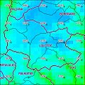
| Overview map | |||

|
|||

|
|||

Lolotoe is an East Timorese administrative office ( Portuguese Posto Administrativo ) in the municipality of Bobonaro . The administrative headquarters are in Suco Deudet in Lolotoe .
geography

Until 2014, the administrative offices were still referred to as sub-districts . Before the 2015 regional reform, Hato-Udo had an area of 169.31 km². Now there are 172.72 km².
Lolotoe is located in the extreme south of the municipality of Bobonaro. In the south and east it borders on the municipality of Cova Lima , in the north on the administrative offices of Bobonaro and Maliana and in the west on the Indonesian West Timor .
The administrative office is divided into seven sucos: Deudet , Gildapil ( Gilapil ), Guda , Lebos , Lontas , Lupal ( Lupai ) and Grandpa . In the north of Gildapil is the mountain Leber ( 1403 m ).
The highest annual rainfall in East Timor is given for the area with 2837 mm.
- Climate data
Annual rainfall (2000)

Average annual temperature (2000)


Residents
6,845 people (2015) live in the administrative office, of which 3,383 are men and 3,462 women. The population density is 39.6 inhabitants / km². The average age is 20.7 years (2010, 2004: 18.6 years). The largest language group are the speakers of the national language Bunak . Lolotoe is one of the centers of the Bunak in East Timor. The official language Tetum is widely used as a second language . Bahasa Indonesia was used during the occupation, the elders still speak Portuguese . This is also taught in schools.
history
In the 18th century, the Lolotoe Empire took part in the Cailaco rebellion against the Portuguese.
In 1999 in East Timor , which was then occupied by Indonesia , there was a wave of violence by pro-Indonesian militias ( Wanra ) and the Indonesian military who wanted to decide the upcoming independence referendum in favor of the occupiers. At the end of May, the then sub-district of Lolotoe was also affected. There have been arbitrary arrests, abuse, rape, torture and murder.
Indonesian soldiers and members of the Kaer Metin Merah Putih (KMP) militia rounded up members and alleged supporters of the CNRT , the umbrella organization of the East Timorese independence movement. Many were beaten and tortured. Women were raped in a named rape house . In 2005, a mass grave was found in Lolotoe with 30 supporters of independence who were killed here.
In early 2010, there were reports that gunmen disguised as ninjas were terrorizing people in the districts of Cova Lima and Bobonaro. Among other things, they were charged with the murder of a 15-year-old girl in Suco Gildapil. The Timorese Police (PNTL) and Army (F-FDTL) then sent units to take action against the criminals.
politics
The administrator of the administrative office is appointed by the central government in Dili. In 2015 this was Almeiro dos R. Pereira .
economy
70% of the households in the administrative office grow coffee, making Lolotoe the cultivation center in the community. In addition, 84% plant cassava, 85% corn, 79% vegetables, 70% coconuts and only 5% rice.
partnership
Since 2009 there has been a partnership with Mount Alexander Shire in Australia .
Web links
- Andrea Fleschenberg: Inventory of the investigation of the past in Indonesia and East Timor , Indonesia Information No. 1 2001
- Serious Crimes Unit : SCU: lolotoe Militia Commander Sentenced To 12 Yrs , April 7, 2003 (English)
Individual evidence
- ↑ a b c d e Direcção-Geral de Estatística : Results of the 2015 census , accessed on November 23, 2016.
- ↑ Jornal da República : Diploma Ministerial no 24/2014 de 24 de Julho - Orgânica dos Postos Administrativos ( Memento of March 4, 2016 in the Internet Archive )
- ↑ a b Direcção Nacional de Estatística: 2010 Census Wall Chart (English) ( Memento from August 12, 2011 in the Internet Archive ) (PDF; 2.5 MB)
- ^ Asian Development Bank: TIM: District Capitals Water Supply Project - Rehabilitation of Lake Lehumo , September 2011 , accessed February 23, 2014.
- ↑ a b Seeds of Life
- ↑ a b Direcção Nacional de Estatística: Census of Population and Housing Atlas 2004 ( Memento of November 13, 2012 in the Internet Archive ) (PDF; 14 MB)
- ↑ Bobonaro District Development Plan 2002/2003 ( Memento of March 28, 2009 in the Internet Archive ) (PDF file; 566 kB)
- ↑ History of Timor ( Memento of March 24, 2009 in the Internet Archive ) (PDF; 824 kB) - Technical University of Lisbon
- ↑ 1999 Crimes against humanity in East Tiomor ( Memento of February 2, 2010 in the Internet Archive )
- ↑ Wikinews, March 24, 2010, “Ninjas” in Timor-Leste?
- ↑ Ministério da Administração Estatal: Administração Municipal ( Memento from June 1, 2016 in the Internet Archive )
- ↑ Direcção Nacional de Estatística: Suco Report Volume 4 (English) ( Memento from April 9, 2015 in the Internet Archive ) (PDF; 9.8 MB)
- ^ Bendigo Advertiser, December 31, 2008, Ties to Timor
Coordinates: 9 ° 10 ′ S , 125 ° 16 ′ E
The administrative borders within East Timor changed in 2015. This article must therefore be checked and updated if necessary. See New Administrative Boundaries .