
Balibo (Administrative Office)
| Administrative office of Balibo | |||
|
|||

|
|||
| Administrative headquarters | Balibo Vila | ||
| surface | 295.97 km² | ||
| population | 15,922 (2015) | ||
| Sucos | Population (2015) | ||
| Balibo Vila | 3,933 | ||
| Batugade | 2,678 | ||
| Cowa | 1,712 | ||
| Leohito | 3.159 | ||
| Leolima | 2.210 | ||
| Sanirin | 2,230 | ||
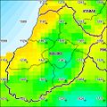
| Overview map | |||

|
|||

|
|||

Balibo ( Balibó ) is an East Timorese administrative office ( Portuguese Posto Administrativo ) in the municipality of Bobonaro . The administrative seat is in Balibo Vila .
“Baliboo” is the Tetum word for “ heron ”.
geography


Until 2014, the administrative offices were still referred to as sub-districts . Before the 2015 regional reform, Balibo had an area of 297.08 km². Now there are 295.97 km².
Balibo is located in the west of the municipality of Bobonaro on the Sawu Sea . In the northeast it borders on the Atabae Administrative Office and in the west across the Nunura River is the Maliana Administrative Office . In the south, Balibo is surrounded by the Indonesian West Timor. A large part of the international border is formed by the Talau River , which eventually flows into the Nunura.
The administrative office is divided into six sucos : Balibo Vila , Batugade , Cowa ( Cová, Kowa ), Leohito ( Leohitu ), Leolima and Sanirin ( Sanir, Saniry ). The Suco Balibo Vila ( Balibo Village ) is located in the center of the administrative office with the main town Balibo Vila in the middle. All other sucos of the administrative office border on Balibo Vila and completely enclose it.
The Important Bird Area Be Malae -Atabae is an area of 3,000 hectares with forest and wetlands of interest for ornithologists.
- Climate data
Annual rainfall (2000)

Average annual temperature (2000)


Residents
The administrative office has 15,922 inhabitants (2015), of which 7,991 are men and 7,931 women. The population density is 53.8 inhabitants / km². The average age is 19.9 years (2010, 2004: 20.0 years). The largest language group is formed by the speakers of the national language Kemak. In Cowa the majority speaks Tetum Terik, while in Batugade there is more Tetum Prasa than Tetum Terik. Kemak is number one in Balibo, followed by Tetum Prasa and minorities from Bekais and Tetum Terik. 75% of the residents of Leohito speak Bekais. In Leolima and Sanirin, almost all residents speak Kemak. There is also a small minority of Bunak speakers. The official language Tetum is widely used as a second language . Bahasa Indonesia was used during the occupation, the elders still speak Portuguese . This is also taught in schools.
history
Colonial times


Balibo, Cowa, and Sanirin were traditional Timorian empires ruled by Liurais . They appear on a list by Afonso de Castro , a former governor of Portuguese Timor who listed 47 empires in 1868. A fortress was built in Balibo by the Portuguese in the 17th century . A second, smaller fortress from 1655 is at Batugade, which was part of the Cowa empire. The Cowas Empire stretched from the north coast to the area of the Dutch West Timor . Batugade Fort served as a colonial prison in the 20th century, while Balibo Fort remained a military post and administrative center.
In 1865 Balibo united with the Tetum empire of Cowa in the fight against the Portuguese. The fact that Cowa was also supported by rulers from the Dutch-dominated western part of the island worried the Portuguese even more. Portugal responded by bombarding the coast with the Sa de Bandeira steamship corvette . In 1868 the Portuguese sent a force to Sanirin in the Batugade military headquarters, whose liurai refused to pay taxes. The Kemak of Sanirin were officially tributaries to Balibo. Also in 1868 an offensive against Cowa and Balibo began from Batugade . In 1871 the Queen of Balibo, Dona Maria Michaelia Doutel da Costa, surrendered . As agreed, she met Governor João Clímaco de Carvalho on May 29 in Batugade . The Queen of Cowa, Dona Maria Pires , did not come. Therefore, on June 1, Dona Maria alone signed the agreements submitted to her, which meant the submission of Balibo as a vassal of Portugal. Cowa did not recognize the supremacy of Portugal until 1881.
In early 1961, the left-wing Office for the Liberation of Timor ( Bureau de Luta pela Libertação de Timor ) attempted an uprising against the Portuguese colonial power. On April 9th they proclaimed a republic in Batugade. However, the Portuguese quickly put down the uprising and the rebels fled to Indonesia.
Indonesian occupation

At the beginning of October 1975, Indonesia began occupying the Portuguese Timor border areas. On October 16, Balibo Vila fell after several skirmishes. Five foreign television journalists, the so-called Balibo Five , were murdered by Indonesian soldiers. They wanted to eliminate witnesses to the infiltration.
According to estimates by Human Rights Watch , around 70% of Balibo Vila was destroyed by militias in the wave of violence surrounding the independence referendum in East Timor in 1999 .
Balibo after the occupation

During the INTERFET (International Force for East Timor) mission , the fortress was used as a base by 1,000 UN troops after the Indonesian withdrawal in 1999 . In the same year Kylie Minogue gave a concert for the UN members as part of her Tour of Duty series of concerts .
Balibo was one of the East Timorese sub-districts that experienced extreme food shortages due to severe weather in November 2007.
politics

The administrator of the administrative office is appointed by the central government in Dili. In 2015 it was Paulo dos Santos .
Culture
Every four years there is a fish festival on Lake Malai ( Be Malae ) , in which the kingdoms of Balibo and Atabae take part. The date varies, but generally falls on August 29th and 30th.
economy
70% of households grow corn, 53% coconuts, 47% cassava, 33% vegetables, 12% rice and 7% coffee. A reforestation project is being carried out at Leolima. There is potential for tourism at the beaches of Batugade and Palaca and at Lake Malai. The most important official border crossing between East Timor and Indonesia is located at Batugade.
Web links
- The Balibo Declaration ( Memento of October 27, 2005 in the Internet Archive ) (English)
- Report on an aid convoy to Balibo in 2000
Individual evidence
- ↑ a b c d e Direcção-Geral de Estatística : Results of the 2015 census , accessed on November 23, 2016.
- ↑ Jornal da República : Diploma Ministerial no 24/2014 de 24 de Julho - Orgânica dos Postos Administrativos ( Memento of March 4, 2016 in the Internet Archive )
- ↑ Geoffrey Hull : The placenames of East Timor , in: Placenames Australia (ANPS): Newsletter of the Australian National Placenames Survey, June 2006, pp. 6 & 7, ( Memento of February 14, 2017 in the Internet Archive ). September 2014.
- ↑ a b Direcção Nacional de Estatística: 2010 Census Wall Chart (English) ( Memento of the original from August 12, 2011 in the Internet Archive ) Info: The archive link was automatically inserted and not yet checked. Please check the original and archive link according to the instructions and then remove this notice. (PDF; 2.5 MB)
- ^ Birdlife International - Be Malae-Atabae
- ↑ a b Seeds of Life
- ↑ a b Direcção Nacional de Estatística: Census of Population and Housing Atlas 2004 ( Memento of November 13, 2012 in the Internet Archive ) (PDF; 14 MB)
- ^ Damien Kingsbury: National Identity in Timor - Leste: A Brief Comparative Study
- ↑ a b Bobonaro District Development Plan 2002/2003 ( Memento of March 28, 2009 in the Internet Archive ) (PDF file; 566 kB)
- ↑ TIMOR LORO SAE, Um pouco de história ( Memento of the original dated November 13, 2001 in the Internet Archive ) Info: The archive link was inserted automatically and has not yet been checked. Please check the original and archive link according to the instructions and then remove this notice.
- ↑ East Timor - PORTUGUESE DEPENDENCY OF EAST TIMOR ( Memento of February 21, 2004 in the Internet Archive )
- ↑ a b History of Timor - Technical University of Lisbon ( Memento of the original from March 24, 2009 in the Internet Archive ) Info: The archive link has been inserted automatically and has not yet been checked. Please check the original and archive link according to the instructions and then remove this notice. (PDF; 824 kB)
- ↑ Ministério da Administração Estatal: Administração Municipal ( Memento of the original from June 1, 2016 in the Internet Archive ) Info: The archive link has been inserted automatically and has not yet been checked. Please check the original and archive link according to the instructions and then remove this notice.
- ↑ Margaret JE King: Fishing Rites at Be-Malai, Portuguese Timor (report of a visit in August 1960), Records of the South Australian Museum, Adelaide, Sth Aust. : Govt. Printer, "From Records of the South Australian Museum, Vol. 15, No. 1, October 6, 1965."
- ↑ Direcção Nacional de Estatística: Suco Report Volume 4 (English) ( Memento of the original from April 9, 2015 in the Internet Archive ) Info: The archive link was inserted automatically and has not yet been checked. Please check the original and archive link according to the instructions and then remove this notice. (PDF; 9.8 MB)
Coordinates: 8 ° 58 ′ S , 125 ° 2 ′ E
The administrative borders within East Timor changed in 2015. This article must therefore be checked and updated if necessary. See New Administrative Boundaries .