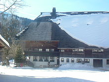
Long-distance skiing trail Hinterzarten – Schluchsee

The Hinterzarten – Schluchsee long-distance skiing trail is 32 kilometers long and is the shorter of the two long-distance skiing trails in the Upper Black Forest (see Schonach – Belchen long-distance skiing trail ). It connects the cross-country skiing center in Hinterzarten with the village of Seebrugg at the southeast end of the Schluchsee .
Route
The Hinterzarten – Schluchsee long-distance ski hiking trail connects the cross-country skiing center in Hinterzarten with the Schluchsee and links numerous circular trails in the southern Black Forest .
Important stations are:
- Hinterzarten (890 m) - start , see photo
- Hinterzarten - Oberzarten district (950 m) - 2 km
- Mathisleweiher (999 m) - 3 km , see photo
- Hinterzarten - Am Feldberg district (1070 m) - 6 km
- Rufenholzplatz (1095 m) - 8 km , see photo
- Raimartihof (1108 m) - 10 km , see photo
- Feldbergpass / Caritashaus (1250 m) - 12 km , see photo
- Hochkopfhütte (1230 m) - 12.5 km
- Farnwitte (1235 m) - 14 km , see photo
- Kapellenkopfhütte (1200 m) - 17 km
- Äulemer Kreuz (1138 m) - 18.5 km , see photo
- Roßhütte (1205 m) - 20 km
- Krummenbach Bridge (1055 m) - 24 km
- Gasthaus Unterkrummen (945 m) - 26 km , see photo
- Schluchsee dam (930 m) - destination , 32 km , see photo
The Fernskiwanderweg links the following cross-country skiing centers:
The route links largely existing circular trails:
- Hinterzarten to Rufenholzplatz: Rinkenloipe
- Rufenholzplatz to Raimartihof: Rinken-Raimartihof trail
- Raimartihof to Farnwitte: connecting trail
- Farnwitte to Äulemer Kreuz: Äulemer-Kreuz-Loipe
- Äulemer Kreuz to Oberer Habsberg: connecting trail
- Upper Habsberg : Habsbergspur Blasiwald
- Oberer Habsberg to Schluchsee dam wall : connecting trail, see photo
Technology, track
The Hinterzarten – Schluchsee long-distance skiing trail is machine-groomed throughout for the classic technique. The trail is marked with black signs throughout.
Skating is not allowed on the long-distance skiing trail, but since the route largely connects existing circular trails, skating is possible on some sections if these circular trails are designed for this technique. This applies to the trails in Hinterzarten and on the Feldberg. Some of the connecting trails are approved for both techniques.
Elevation profile, character, ambition
With a total length of 32 kilometers, the route has its lowest point at 890 meters in Hinterzarten, and its highest point at 1250 meters at the Feldberger Caritashaus. This difference in altitude of 360 meters is converted into a total of approx. 550 meters in altitude through numerous ascents and descents. This means that the route is not so demanding that it cannot be tackled in one day.


