Feldberg Pass
| Feldberg Pass | |||
|---|---|---|---|
|
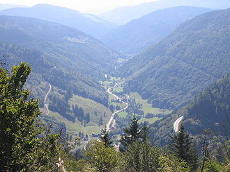
View from Feldberg to Brandenberg-Fahl . The pass road can be seen on the right. |
|||
| Compass direction | west | east | |
| Pass height | 1231.3 m above sea level NHN | ||
| state | Baden-Württemberg | ||
| Valley locations | Todtnau | Titisee-Neustadt | |
| expansion | B 317 | ||
| Mountains | Black Forest | ||
| particularities | Second highest road pass in Germany | ||
| profile | |||
| Max. Incline | 10% | 10% | |
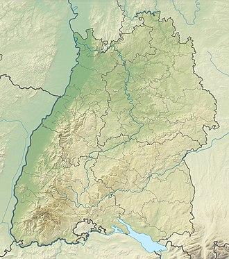
| Map (Baden-Württemberg) | |||
|
|
|||
| Coordinates | 47 ° 51 '23 " N , 8 ° 1' 45" E | ||
The Feldbergpass is at 1231.3 m above sea level. NHN the second highest mountain pass in Germany. It is located in the Black Forest ( Baden-Württemberg , Germany ) between the Feldberg ( 1493 m above sea level ) in the north and the Grafenmatt ( 1377 m above sea level ) in the south. The top of the pass at the Zeiger and the east ramp are in the area of the municipality of Feldberg .
history
The first discussions about building a road over the Feldberg took place around 1840 in the Wiesental . Not only the communities, but also the industrial companies in the valley wanted a connection to the Baar , because they obtained their raw materials from the Baar and the upper part of Württemberg (brush industry) and from Austria (tinder industry) and wanted to open up new sales markets there. Until then, the raw material deliveries had to take the route over the Hohe Wacht ( Bernau ) pass and the Prägbachtal . Shortly before the revolution of 1848/49 , a mule track Todtnau –Zeiger– Bärental –Altglashütten was created and connected with paths to Lenzkirch and St. Blasien . In 1847 the state had recognized the road project as important, but there was a dispute over the financing, which should be provided by the neighboring communities and the Fürstenberg Princely House . In 1866 a state grant of 20,000 guilders was granted, and in 1868 Bärental and the Fürstenberg family agreed to expand the route to the border with Menzenschwand . After the preparatory work had started in 1874, the street was opened in 1885. The road was not cleared in winter, but was used by snowshoe hikers, ice skaters and pedestrians.

In 1908 a widening of the road was planned, the financing of which initially failed again due to the municipalities. After the municipality of Bärental was obliged to contribute in 1912, work began in 1913, which led to a 33% widening and a reduction in the gradient from an average of 10.3 to 7.85%. On April 1, 1926, he was appointed county road , before becoming Reichstrasse or Bundesstrasse 317 on April 1, 1935 . In 1927 the connection through the Seewald was made passable, in 1932/34 the first asphalt pavement followed and in 1938/39 large parking lots and the road administration's farm were built in the area around the pointer.
traffic
The busy pass road is part of the B 317 and connects Todtnau in Wiesental with Titisee-Neustadt . The south-westerly driveway is marked by serpentines and overcomes a height difference of 483 m for about seven kilometers, the north-eastern ramp is less winding. Both ramps have gradient maxima of up to 10%. Snow chains are mandatory for trucks on the pass road . In the pass area, two more mountain roads branch off, north to the Feldberg summit and south to the Federal Training Center of the DSV on the Herzogenhorn ( 1415.6 m above sea level ). In winter 2005/2006 the road was closed to avalanches after heavy snowfall .
tourism
In summer the Feldberg Pass is often used as a starting point for hikes in the Feldberg nature reserve . There are numerous parking spaces available for this. As part of the tourist development, numerous accommodations, restaurants and climbing aids were created, especially for winter sports.
The Feldberg winter sports area has been located on both sides of the pass for several decades. It comprises 14 lifts and 16 runs from the simple family run to the demanding FIS World Cup run. Cross- country skiers have access to the trails on the Herzogenhorn (approx. 20 km), on the Köpfle (3 km), on the Äulemer Kreuz and the Stübenwasenspur from the Feldberg Pass . The 32-kilometer long- distance skiing trail Hinterzarten – Schluchsee also leads over the Feldberg Pass .
The high volume of traffic in the area of the Feldberg Pass caused by tourism leads to major problems, especially in winter, which are often exacerbated by the winter road conditions. Therefore, a parking garage was built on the pass to relieve the parking spaces along the road.
The Feldbergpass was part of the Deutschland Tour twice with mountain arrivals . In the mountain classification, the southwest ramp is in the first category. In 2003 the Portuguese José Azevedo won , in 2005 the Australian Cadel Evans .
Web links
- Feldbergpass (1231 m) - pass description
- Elevation profile from Todtnau

