Fisher Island
| Fisher Island | ||
|---|---|---|
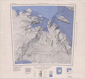
| FISHER ISLAND in the northwest area of the topographical map sheet | ||
| Waters | Sulzberger Bay | |
| Geographical location | 77 ° 7 ′ S , 154 ° 19 ′ W | |
|
|
||
| length | 12.3 km | |
| width | 8.3 km | |
| surface | 80 km² | |
The Fisher Island (or Fisher Iceland ) is a good 12 km long, ice-covered island north of King Edward VII Land . It limits the entrance to Sulzberger Bay to the west . It is separated from the Antarctic mainland , especially from the Saunders coast , which borders the Edward VII Peninsula in the north, over a distance of 1.6 km by the western foothills of the Swinburne Ice Shelf .
It was mapped by the United States Geological Survey and using aerial photographs by the United States Navy between 1959 and 1965. The Advisory Committee on Antarctic Names named it in 1966 after Wayne Fisher, an employee of the US State Department .
Web links
- Fisher Island in the Geographic Names Information System of the United States Geological Survey (English)
- Fisher Island on geographic.org

