Swinburne Ice Shelf
Coordinates: 77 ° 10 ′ S , 153 ° 55 ′ W
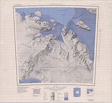
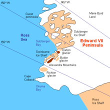
The Swinburne Ice Shelf is a 32 km long and 8 km wide ice shelf off the Saunders coast of the West Antarctic Marie Byrd Land . It lies immediately north of the Edward VII Peninsula and the Alexandra Mountains in the southern part of Sulzberger Bay and extends from Fisher Island to the White Islands .
Participants in the first Antarctic expedition (1928–1930) by the US polar explorer Richard Evelyn Byrd made aerial photographs and mapped them out. The Advisory Committee on Antarctic Names named the ice shelf in 1971 after Harry William Swinburne Jr. (1923-1991), deputy commandant and chief of staff of the US Navy support units in Antarctica during Operation Deep Freeze in 1970 and 1971.
Web links
- Swinburne Ice Shelf in the Geographic Names Information System of the United States Geological Survey
- Swinburne Ice Shelf on geographic.org


