White Islands (Antarctica)
| White Islands | ||
|---|---|---|
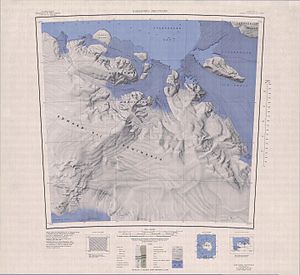
| Topographic map (1: 250,000) with the White Islands (top center) | ||
| Waters | Sulzberger Bay | |
| Geographical location | 77 ° 17 ′ S , 153 ° 10 ′ W | |
|
|
||
| Number of islands | 3 | |
The White Islands are a group of three icy islands in the southern Sulzberger Bay off the Saunders coast of the west Antarctic Marie-Byrd-Land . In north-south orientation, they are distributed east of the Swinburne Ice Shelf and near the mouth of the Butler Glacier over a length of 16 km.
In maps from the first Antarctic expedition (1928–1930) by the US polar explorer Richard Evelyn Byrd , they are described as “low ice cliffs” rising from the ice shelf. The United States Geological Survey carried out a detailed mapping based on its own surveys and aerial photographs of the United States Navy from 1959 to 1965. The Advisory Committee on Antarctic Names named the islands in 1970 at Byrd's suggestion after the American heart surgeon Paul Dudley White (1886–1973), medical advisor in Operation Highjump (1946–1947), which was also led by Byrd .
Web links
- White Islands in the Geographic Names Information System of the United States Geological Survey (English)
- White Islands on geographic.org (English)

