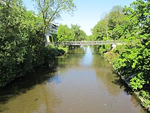
Flutgraben (Erfurt)

The Flutgraben is a large moat that surrounds the old town of Erfurt in the south, east and north. It was laid out between 1890 and 1898 and serves to protect the Gera from flooding .
location
The Flutgraben branches on paper weir ( 50 ° 57 '44.43 " N , 11 ° 0' 37.77" O ) at the high-Straße between Hochheim and the Brühlervorstadt right of Gera from, followed by the Erfurt city ring road east to the city center, merges again with the Gera between Talstrasse and Waldemarstrasse in the Andreasvorstadt , after the bottom crash on the Nettelbeckufer ( 50 ° 59 ′ 15.91 ″ N , 11 ° 1 ′ 19.97 ″ E ). The flood ditch is 5400 meters long, at the bottom 20 meters wide, holds 250 m³ / s (maximum discharge of all Gera arms together in Erfurt 6 m³ / s) and protects the historic old town and particularly flood-prone structures such as the Krämerbrücke from flooding and water damage .
history
Since the Gera and its tributaries drain a large part of the highest mountains in the Thuringian Forest , severe floods have always been a problem in Erfurt, especially when heavy snowmelt coincided with precipitation. The Gera in Erfurt is divided into many arms, which were able to discharge a certain amount of water, but if this was exceeded, a large part of the city was immediately under water. The moats have always been used for flood protection, the Wilde Gera on the inner and the moat on the outer Erfurt city fortifications . However, this led to some damage to these facilities, which is why the Prussian military prohibited the use of the moat for this purpose when the city became part of the kingdom in 1815. This exacerbated the risk of flooding in the old town.
Already in the middle of the 19th century there were plans to rebuild the Gera in the city area, but they were never implemented. Only when the fortress status of the city of Erfurt was lifted in 1873 did flood protection planning move again. Construction plans were drawn up and approved by the city council. It was agreed to significantly expand the former fortress moat and then to fill in the Wilde Gera in the old town.
Construction work on the flood ditch began in 1890. During a flood in November 1890, it was found that a discharge rate of 250 m³ / s was necessary for safe protection of the city, but the plans were only based on 200 m³ / s, which is why they were revised again. In addition to new road bridges, a culvert was also built. At today's bridge in Schlüterstraße , it passes under the narrow Gera under the flood ditch. This culvert, built in 1895, consists of five tubes with a diameter of 1.20 meters. In 1898 the flood ditch was completed and then the Wilde Gera was filled in. The first ring road (today's Juri-Gagarin-Ring ) was laid out on it. The construction of the flood ditch cost 1.7 million marks, with a construction worker getting about 1.50 marks a day, and was financed by the city of Erfurt. A total of 560,000 m³ of earth was excavated. In addition, twelve bridge structures were built.
Since its completion, the flood ditch has been able to reliably protect Erfurt's old town from flooding.
Web links
Individual evidence
- ↑ Dietrich Baumbach, Hans-Jörg Vockrodt: Historical arch and vault bridges in the city of Erfurt. Habel, 2000, ISBN 3-00-006938-0 , p. 9.

