Fort Smith (Northwest Territories)
| Fort Smith | ||
|---|---|---|
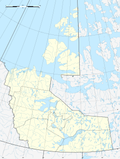
| Location in Canada | ||
|
|
||
| State : |
|
|
| Territory : | Northwest Territories | |
| Region: | South Slave Region | |
| Coordinates : | 60 ° 0 ′ N , 111 ° 54 ′ W | |
| Height : | 205 m | |
| Area : | 92.79 km² | |
| Residents : | 2496 (as of 2011) | |
| Population density : | 26.9 inhabitants / km² | |
| Time zone : | Mountain Time ( UTC − 7 ) | |
| Postal code : | X0E 0P0 | |
| Area code : | +1 867 | |
| Mayor : | Lynn Napier-Buckley | |
| Website : | www.fortsmith.ca | |
Fort Smith is a small town in Canada and is located immediately north of the 60th parallel north , which forms the border between the Northwest Territories and the province of Alberta south of it . Fort Smith is called "the gateway to the north". Fort Smith has 2496 inhabitants (as of 2011).
Fort Smith is the seat of one of the two regional offices of the South Slave Region , the administration of Wood Buffalo National Park and the Diocese of Mackenzie-Fort Smith .
geography
The city is located at the 60th parallel (111 ° 54'W), so there is a 60th Parallel Visitor Center there . The city is on the Slave River and on NWT Highway 5 . To the west of the city is Fort Smith Airport ( IATA code YSM).
Attractions
The Northern Life Museum focuses on the history of northwest Canada and the ethnic groups living there.
Born in Fort Smith
- Mark Carney (* 1965), Canadian bank manager and the first foreign governor of the Bank of England
- Betsy Mawdsley (* 1988), Canadian biathlete
