
Frank's settlement
.ajb.jpg)

The Frank'sche Siedlung is located in the Klein Borstel district of today's Hamburg district of Ohlsdorf . With 545 houses, it is the largest closed row house development in Hamburg in the 1930s and one of the outstanding residential construction projects of that time.
location
The settlement borders in the north on Wellingsbütteler Landstraße , in the east on the street Borstels Ende , in the south on the street Stübeheide or the Alstertalbahn . The western border is not uniform, since the 1950s the area of the Albert Schweitzer School (district school and district elementary school) has formed the end of the settlement.
It divides the residential development on Kornweg , which already existed before the planning of the settlement, into a western and an eastern part. In addition to parts of Wellingsbütteler Landstrasse and the streets Stübeheide , Kornweg and Borstels Ende , the streets Stübekamp , Stüberedder , Am Stein , Övern Block and Övern Barg are now part of the settlement.
history

The settlement was a central project of the housing association of the brothers Hermann and Paul Frank , in which they planned small terraced houses (originally with 57 m² of living space) with narrow, elongated gardens, which could also be used by middle-income families and which had no higher rents than inner-city rents Should have apartment buildings. The Frank brothers saw the project as a future-oriented form of settlement influenced by the garden city idea, which should enable inexpensive living in the countryside.
The construction site at the then state border offered almost 15 hectares of free space, which was already well connected to the Hamburg transport network by the Alstertalbahn . The plans quickly aroused resistance from previous residents, who saw it as an urban and social danger. An extensive information campaign with the participation of specialist authorities and the NSDAP was able to refute the counter-arguments, so that construction began in 1935.
The first construction phase was completed in 1935 in the western part in the record time of 16 weeks. The buildings were strictly aligned in rows and hardly varied.
The second, larger construction phase was built between 1936 and 1939 in the eastern part. Here the arrangement and design of the houses is more differentiated, the communal green spaces are more complex, the entire part of the settlement has a more closed character. The second construction phase also saw the creation of local amenities, such as a primary school and a church on Stübeheide street and a row of shops near the S-Bahn station.
The design of the houses shows a mixture of elements from the New Building of the 1920s and the Heimatschutz style favored in the 1930s .
Living concept
For all construction phases, two-storey, 4.3 m wide house types were lined up in rows that are up to 85 m long and contain up to 20 houses. Approx. 100 m² gardens corresponding to the width of the house extend from the back of the houses to a footpath running between the rows of houses. Through traffic was largely avoided, the entrance sides of the houses are accessed through narrow residential streets in the form of side streets or rings . An essential innovation is the alignment of the rows of houses with the gable facing the main streets. As a result, the orientation of the houses could often be chosen in such a way that living rooms and terraces faced south or west facing the sun and were nevertheless little affected by through traffic.
The houses are uniformly designed with red brick masonry, saddle roofs and defined window structures. In the interior, all show the basic type of a 4-room apartment with living and kitchen area on the ground floor, bedrooms on the first floor, an expansion reserve in the attic and bathroom, toilet and utility rooms in the basement. A maximum of 101 m² of living and usable space was available per house, which at the time of construction was considered sufficient for a family of up to ten people.
The gardens assigned to the houses are an important part of the concept, as they should also support the supply of the residents with food. For the design of the green spaces in the settlement, the typical bent landscape was the model. Large trees such as oaks were preserved and were supplemented by mountain ash and birch . Small public open spaces and horticultural designed entrance areas loosen up the structure further.
Until the 1970s, the residents lived exclusively with inheritable permanent residence rights. In the meantime, large parts of the houses have been sold to the residents and are being traded on at market prices. The settlement has been very popular as a residential area since its creation.
Monument protection
Extensive regulations for maintaining the appearance have been in effect for the entire settlement since April 1981 . It has been a listed building since April 2011. Since then, modernization and expansion measures must be in accordance with the current monument preservation plan. Among other things, this provides rules for the uniform design of windows, doors, dormers , facades, canopies and winter gardens .
Individual buildings
List of all listed individual buildings:
Photographs and map

Coordinates: 53 ° 38 ′ 5 ″ N , 10 ° 3 ′ 18 ″ E


Entrance to
Haus Kornweg 17e
Front gardens on Kornweg

Entrance to Kornweg,
around 1982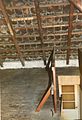
Undeveloped attic
.jpg)


.jpg)
literature
- Ralf Lange : Architecture in Hamburg . Junius Verlag , Hamburg 2008, ISBN 978-3-88506-586-9 , p. 238 .
- Dirk Schubert: Hamburg's residential areas . Dietrich Reimer Verlag, Berlin 2005, ISBN 3-496-01317-6 , p. 188-191 .
- Axel Iwohn, Martina Nath-Esser, Claudia Wollkopf: Hamburg Grün - The gardens and parks of the city . L&H Verlag, Hamburg 1998, ISBN 3-928119-39-7 , p. 179 f .
Individual evidence
- ↑ Schubert, Hamburger Wohnquartiere , p. 188 (see section Literature) gives 547 houses, the list of monuments of the city of Hamburg and the description on the website of the Hamburg-Nord district give 545 houses.
- ↑ On the level of the selling prices of houses in the settlement cf. Article in the Hamburger Abendblatt of July 25, 2012. Accessed November 7, 2014.
- ^ Ordinance of the City of Hamburg on the environmental protection of the settlement. Retrieved November 7, 2014.
- ^ Ordinance of the City of Hamburg on the monument protection of the settlement. Retrieved November 7, 2014.
- ^ Monument conservation plan of the Hamburg-Nord district for the settlement. Retrieved November 7, 2014.
Web links
- Description on the website of the Hamburg-Nord district