Gang Benchen
| Gang Benchen | ||
|---|---|---|
|
Gang Benchen from the north |
||
| height | 7281 m | |
| location | Tibet Autonomous Region ( PR China ) | |
| Mountains | Baiku Kangri ( Himalaya ) | |
| Dominance | 24.83 km → Porong Ri | |
| Notch height | 1340 m ↓ unnamed pass ( 5941 m ) between Nandanli and Daqu | |
| Coordinates | 28 ° 33 '6 " N , 85 ° 32' 45" E | |
|
|
||
| First ascent | April 21, 1982 by a Japanese expedition | |
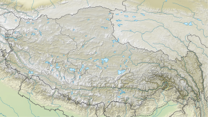
The Gang Benchen - also known as Kang Benchen , Kangboqen , Kangbengquin , Kangpenqin , Kangbochin or Kangpengqing - is the highest elevation of the Baiku Kangri , a mountain range that branches off the main Himalayan chain northwest of Shishapangma , reaching northwest .
In addition to the different spellings of the name, different altitude information in the range from 7211 m to 7299 m are known.
Ascent history
The first ascent was made on April 1, 1982 by Riyuko Morimoto, Kozo Matsubayashi, Kazunari Ushida, Shim Koshima, Takao Morito, Goro Hitomi, Kiyoshi Nakagawa and Hiroshi Kondo, members of a Japanese expedition. The following day, Shoichiro Ueo, Takashi Nishiyama and Rikuyo Morimoto reached the summit.
Web links
Commons : Gang Benchen - collection of images, videos and audio files
- Kangpenqing, China on Peakbagger.com (English)
- Photos and description at summitpost.org
- Photo at mountainsoftravelphotos.com
- another photo at mountainsoftravelphotos.com
Individual evidence
- ↑ mountainsoftravelphotos.com
- ↑ Academic Alpine Club of Kyoto ( Memento of the original from March 4, 2016 in the Internet Archive ) Info: The archive link was inserted automatically and has not yet been checked. Please check the original and archive link according to the instructions and then remove this notice.
- ↑ a b Asia, China, Gang Ben Chen . AAJ, 1983, vol. 25th

