
Gehlenbeck Mountain
| Gehlenbeck Mountain | ||
|---|---|---|
| height | 275 m | |
| location | District of Minden-Lübbecke , North Rhine-Westphalia | |
| Mountains | Wiehengebirge | |
| Coordinates | 52 ° 18 ′ 0 ″ N , 8 ° 39 ′ 19 ″ E | |
|
||

The Gehlenbecker Berg is a 275 meter high mountain in the Wiehengebirge . The mountain lies in the area of the East Westphalian town of Lübbecke , near the border with the municipality of Hüllhorst in the Minden-Lübbecke district . The summit itself is pathless; The Wittekindsweg runs 100 meters south .
The mountain got its name from the village of Gehlenbeck , a district of Lübbecke, the center of which is around 1.5 kilometers northwest of the mountain peak. The Gehlenbeck mountain is located on the northernmost bulge of the eastern Wiehengebirge and is therefore the northernmost mountain on the main ridge of this part of this ridge. The village of Ahlsen is around 1 kilometer south of the summit. The summit area has a large population of oaks.
The shortest distance between the northern and southern tree line of the Wiehengebirge in this area is only 650 meters, as cultivated land protrudes unusually high into the mountains both in the north and from the Ravensberger Mulde : In Gehlenbeck, grassland extends up to 145 meters above sea level. NN, in the south arable land even up to 230 meters above sea level. NN.
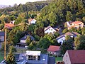
In the area of the mountain, here Gehlenbeck, cultivated land extends particularly far into the mountains.
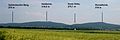
View of the Gehlenbeck mountain from the north-west (far left on the picture).

The map shows the elevation stratification around the mountain.

