Border and garrison town of Elvas with its fortifications
| Border and garrison town of Elvas with its fortifications | |
|---|---|
|
UNESCO world heritage |
|

|
|
| Historic center of Elvas |
|
| National territory: |
|
| Type: | Culture |
| Criteria : | iv |
| Surface: | 179 ha |
| Reference No .: | 1367 |
| UNESCO region : | Europe and North America |
| History of enrollment | |
| Enrollment: | 2012 (session 36) |
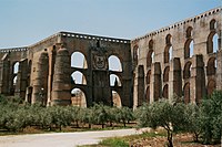
Garrison town border and Elvas with its fortifications is the name for one in 2012 by the UNESCO declared World Heritage Site in Portugal . After regaining and maintaining independence of the country (1640), Elvas, which was expanded into a fortress town in the 17th to 19th centuries, is home to the largest preserved bulwark fortifications in the world. Within the city walls there are barracks and other military buildings as well as churches and monasteries, some of which performed a military function themselves. The fortifications were designed by the Jesuit Father Cosmander and represent the world's best-preserved example of Dutch fortification architecture . The Amoreira aqueduct , which is also part of the world heritage, played a key role in supplying the city during sieges .
Cultural-historical classification
The remnants of the former war fortress form "an extraordinary military landscape with optical and functional relationships between the individual components that embody the developments of Dutch, Italian, French and British military architecture and technology in theory and practice".
UNESCO justified the inclusion of Elvas in the World Heritage List with "the extraordinary example of a garrison town and its bulwark defense system, which developed in response to the disturbances in the European balance of power in the 17th century". Elvas represented "the universal ambitions of European states in the 16th and 17th centuries for autonomy and land".
overview
The garrison town of Elvas is located in a landscape characterized by rivers and rolling hills on the Portuguese-Spanish border between the capitals Lisbon and Madrid . The strategically important location led to extensive fortification with bulwark fortifications and a belt of fortifications built on the surrounding hills between the 17th and 19th centuries .
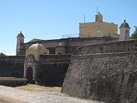
The belt, begun in 1643, consists of twelve individual forts, which are distributed in the form of an irregular polygon around the central fort . The steeply inclined bulwarks of the city are surrounded by a dry trench and a Kontreeskarpemauer and are also protected by several ravelins . The Dutch Jesuit Cosmander designed the fortifications, drawing on the theoretical preparatory work of Samuel Marolois , who, together with Simon Stevin and Adam Fritach, is considered to be the founder of the Dutch school in fortress construction.
In the 18th century the Graça Fort and four smaller forts were built to the west of the city in response to greater artillery ranges.
List of World Heritage Sites
| ID | Surname | location | Area in ha | description | image |
|---|---|---|---|---|---|
| 1367-001 | Amoreira aqueduct | map | 0.81 | The Amoreira Aqueduct has a total length of 7504 meters from the main source to Largo da Misericórdia . 843 arches over a length of 1113 meters in the valley of São Francisco reach a height of 31 meters in up to four layers. A section of the aqueduct runs underground to a depth of 6 meters. |

|
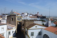
| 1367-002 | Historical center | map | 125.43 | The historical center with the castle , remains of the city wall and civil and religious buildings testify to the development of three fortified cities between the 10th and 14th centuries. During the expansion to a garrison town during the Restoration War (1641–68), the large bulwark fortifications and a large number of military buildings were built. |

|
| 1367-003 | Fort of Santa Luzia with covered path | map | 19.71 | The star-shaped fort of Santa Luzia was built between 1641 and 1648 on a ledge 410 meters southeast of the city fortress and is connected to it by a wide covered path . The fort was protected by two lines of defense with two dry moats. Inside the fortress is a military museum and the central redoubt with powder magazines, a chapel and the governor's house. |

|
| 1367-004 | Fort of Graça | map | 11.25 | The fort was built in 1763 on the 404 meter high Monte da Graça about 1 km north of the city. It consists of three main lines of defense with two main trenches. Inside the fort there are barracks, powder magazines, warehouses, cisterns, officers' quarters and a two-story rococo-style governor's house . Masses were held in the central redoubt in the 19th century . |

|
| 1367-005 | Fortim de São Mamede | map | 7.96 | The Fortim de São Mamede, built on a small hill, controlled the southeast slope of the Santa Luzia Fort. The small fortress was equipped with a moat, a guard house, a powder magazine and a small warehouse. | |
| 1367-006 | Fortim de Sao Pedro | map | 1.98 | The Fortim de São Pedro south of Elvas served at the same time to defend the city and Fort Santa Luzia. It was protected by two trusses and a trench. |

|
| 1367-007 | Fortim de São Domingos | map | 12.20 | The Fortim de São Domingos was built west of the city to defend the aqueduct. In addition to the walls and a moat, three trusses were used for protection. |
See also
Web links
- Entry on the UNESCO World Heritage Center website ( English and French ).
- Nomination file (English)
Individual evidence
- ↑ a b c d e f Garrison Border Town of Elvas and its Fortifications. whc.unesco.org, accessed May 10, 2015 .
- ↑ The Garrison Border Town of Elvas and its Fortifications (nomination file), pp. 127–128.
- ↑ The Garrison Border Town of Elvas and its Fortifications (nomination file), pp. 82–84.
- ^ The Garrison Border Town of Elvas and its Fortifications (nomination file), pp. 98-100.
- ↑ a b c The Garrison Border Town of Elvas and its Fortifications (nomination file), p. 119.
