Elvas
| Elvas | ||||||
|---|---|---|---|---|---|---|
|
||||||
| Basic data | ||||||
| Region : | Alentejo | |||||
| Sub-region : | Alto Alentejo | |||||
| District : | Portalegre | |||||
| Concelho : | Elvas | |||||
| Coordinates : | 38 ° 53 ′ N , 7 ° 10 ′ W | |||||
| Residents: | 23,078 (as of June 30, 2011) | |||||
| Surface: | 631.28 km² (as of January 1, 2010) | |||||
| Population density : | 37 inhabitants per km² | |||||
| Elvas County | ||||||
|
||||||
| Residents: | 23,078 (as of June 30, 2011) | |||||
| Surface: | 631.28 km² (as of January 1, 2010) | |||||
| Population density : | 37 inhabitants per km² | |||||
| Number of municipalities : | 7th | |||||
| administration | ||||||
| Administration address: | Município de Elvas Rua Isabel Maria Picão Apartado 70 7350-953 Elvas |
|||||
| President of the Câmara Municipal: | José António Rondão Almeida ( PS ) | |||||
| Website: | www.cm-elvas.pt | |||||
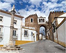
Elvas is a city ( Cidade ) and a district ( concelho ) in Portugal with 23,078 inhabitants (as of June 30, 2011). The city is located on a hill dominating the plain in the Portalegre district of the Alentejo region near the Spanish border, about 15 km west of Badajoz . The largest preserved bulwark fortifications in the world are located here. The UNESCO took them and the entire historical center of the town of Elvas, entitled Garrison Border Town of Elvas and its Fortifications 2012 in the list of World Heritage in.
history
The area has been inhabited since the Paleolithic . When the Romans arrived in the 2nd century BC A fortified Celtic settlement of the Castro culture existed here . A large number of finds, including 23 Villae , prove the relative importance of the place in the province of Lusitania . After the invasion of the Visigoths from the 5th century onwards, the Moors conquered the place at the beginning of the 8th century and built important Arab fortifications on the remains of the Roman fortifications. After a first conquest in 1166 by Portugal's first king, D.Afonso Henriques , Elvas first became Christian in 1226 and then in 1230. The first city charter granted after the final reconquest was renewed by King Manuel I in 1512. Elvas also became a bishopric in 1570.
On January 14, 1659, the site was the scene of the battle of Batalha de Linha de Elvas , which played a major role in the outcome of the Restoration War, in which Portugal regained its independence from Spain.
Elvas picked and to the Spanish Queen Maria Luisa of Bourbon-Parma skillful oranges gave the War of the Oranges in 1801 his name. Its long tradition as a fortress town continued in Elvas during the Napoleonic invasions until 1812. After Elvas sided with the defeated absolutists in the Liberal Revolution of 1822 , the city began to decline in importance. In 1881 Elvas lost his bishopric, which had remained vacant since 1852, although in the meantime the opening of the royal road to Lisbon in 1857 and the arrival of the railroad in 1863 initiated a new, relative prosperity.
Anti-Republican putschists , including the later President Gomes da Costa , served prison sentences here after their attempted coup in 1925, during which they planned their coup d'état successfully carried out in 1926. The semi - fascist Estado Novo regime that followed, established in 1932, promoted Elvas, particularly in the 1940s. However, the city never regained its old position, and when Portugal joined the EU in 1986, it also lost its importance as a border town.
Fought over through the centuries and steadily fortified, Elvas is home to the largest preserved bulwark fortifications in the world. Since 30 June 2012, they include, as well as the entire historic city center, the World Heritage of UNESCO .
Sights and culture
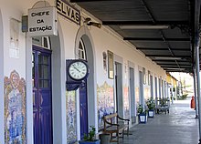
220 architectural monuments are registered in the Elvas district (as of July 26, 2013). The best known include the fort and the fortresses, the city walls, and the 7540 meter long, four-story Amoreira aqueduct (Aqueduto da Amoreira) , with spans of up to 14 meters. It was started in 1498 and completed in 1622 and is a symbol of the city. A large number of sacred buildings , fountains, schools, mansions , gardens and historical public buildings such as the Caia border station, the central cinema and the station building make up the majority of the protected structures. In the old town are u. a. the former cathedral , consecrated in 1537, and the church of the Santo Domingo Monastery, founded around 1550. The old town with its winding streets and squares, Art Deco houses, fountains and churches is also a listed building as a whole.
The Museum of Modern Art (Museu de Arte Contemporânea) has been one of the most important cultural sites in the city since 2007 , in which the Colecção António Cachola, one of the most important private collections of contemporary Portuguese art, was made accessible to the public. Two military museums, a sacred art museum, and an architecture museum are some of the other museums in the city.
administration
circle
Elvas is the administrative seat of a district of the same name, which borders on Spain in the southeast . The neighboring areas are (starting clockwise in the north): Arronches , Campo Maior , Alandroal , Vila Viçosa , Borba and Monforte .
With the regional reform in September 2013, several municipalities were merged into new municipalities, so that the number of municipalities decreased from eleven to seven.
The following municipalities ( Freguesias ) are in Elvas County:
| local community | Population (2011) |
Area km² |
Density of population / km² |
LAU code |
|---|---|---|---|---|
| Assunção, Ajuda, Salvador e Santo Ildefonso | 9,688 | 98.66 | 98 | 120712 |
| Barbacena e Vila Fernando | 979 | 82.53 | 12 | 120714 |
| Caia, São Pedro e Alcáçova | 6.253 | 104.04 | 60 | 120713 |
| Santa Eulália | 1,198 | 98.52 | 12 | 120706 |
| São Brás e São Lourenço | 1,684 | 47.63 | 35 | 120707 |
| Sao Vicente e Ventosa | 801 | 101.68 | 8th | 120708 |
| Terrugem e Vila Boim | 2,475 | 98.22 | 25th | 120715 |
| Elvas County | 23,078 | 631.28 | 37 | 1207 |
Population development
| Population in Elvas County (1801–2011) | ||||||||
|---|---|---|---|---|---|---|---|---|
| 1801 | 1849 | 1900 | 1930 | 1960 | 1981 | 1991 | 2001 | 2011 |
| 16,963 | 15,425 | 21,548 | 24,711 | 28,562 | 24,981 | 24,474 | 23,361 | 23,078 |
Municipal holiday
- January 14 (memorial day of the battle of January 14, 1659)
Town twinning
traffic
The city can be reached via the Linha do Leste railway line . From January 1, 2012 to August 28, 2017, only goods traffic was handled on the route, since then there has been another pair of trains between Badajoz and Entroncamento on the Linha do Norte .
Elvas is part of the national bus network of the Rede Nacional de Expressos .
Elvas is connected to the country's road network via the A6 motorway and the N4 national road.
sons and daughters of the town
- Pedro Margalho (1474–1556), philosopher, cosmographer, theologian and lawyer
- Manuel Rodrigues Coelho (1555–1633), organist and composer
- Luís Gomes da Mata (1558–1607), financier, holder of the postal monopoly in Portugal
- José Francisco de Abreu (1753-?), Architect
- José Lúcio Travassos Valdez (1787–1862), Count von Bonfim, politician, Prime Minister
- João de Fontes Pereira de Melo (1780–1856), military, naval minister, governor of Cape Verde
- Luís da Silva Maldonado de Eça (1808–1879), general and politician, Minister of War 1869/1870
- Joaquim Filipe Nery da Encarnação Delgado (1835–1908), Army General and geologist
- Luís Leitão (1866–1940), writer, journalist and philanthropist
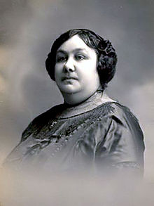
- Adelaide Cabete (1867–1935), feminist, doctor, Freemason, animal rights activist and Republican politician
- Francisco António Brás (1905–1922), poet
- Sofia Pomba Guerra (1906-early 1970s), pharmacist, teacher and communist resistance fighter
- Patalino (1922-1989), football player
- Amadeu Lopes Sabino (* 1943), writer
- Paco Bandeira (* 1945), musician
- João Loy (* 1961), film and television actor and theater director
- César Magarreiro (* 1964), naval officer, writer and geographer
- Henrique Sereno Fonseca (born 1985), football player
See also
Web links
Individual evidence
- ↑ a b www.ine.pt - indicator resident population by place of residence and sex; Decennial in the database of the Instituto Nacional de Estatística
- ↑ a b Overview of code assignments from Freguesias on epp.eurostat.ec.europa.eu
- ↑ www.verportugal.net , accessed July 26, 2013
- ↑ History page on the website of the city administration ( Memento of the original from December 30, 2017 in the Internet Archive ) Info: The archive link was inserted automatically and has not yet been checked. Please check the original and archive link according to the instructions and then remove this notice. , accessed July 26, 2013
- ↑ www.monumentos.pt , accessed on July 26, 2013
- ^ Lydia Hohenberger, Jürgen Strohmaier: Portugal . 2nd edition, DuMont Reiseverlag, Ostfildern 2009, p. 326.
- ^ Publication of the administrative reorganization in the Diário da República gazette of January 28, 2013, accessed on March 16, 2014
- ↑ www.anmp.pt , accessed on July 26, 2013
- ^ [1] Communication from the CP


