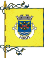
Sousel
| Sousel | ||||||
|---|---|---|---|---|---|---|
|
||||||
| Basic data | ||||||
| Region : | Alentejo | |||||
| Sub-region : | Alto Alentejo | |||||
| District : | Portalegre | |||||
| Concelho : | Sousel | |||||
| Coordinates : | 38 ° 57 ′ N , 7 ° 41 ′ W | |||||
| Residents: | 1932 (as of June 30, 2011) | |||||
| Surface: | 89.28 km² (as of January 1, 2010) | |||||
| Population density : | 22 inhabitants per km² | |||||
| politics | ||||||
| Address of the municipal administration: | Junta de Freguesia de Sousel Largo do Jardim 7470-231 Sousel |
|||||
| Circle Sousel | ||||||
|
||||||
| Residents: | 5074 (as of June 30, 2011) | |||||
| Surface: | 279.32 km² (as of January 1, 2010) | |||||
| Population density : | 18 inhabitants per km² | |||||
| Number of municipalities : | 4th | |||||
| administration | ||||||
| Administration address: | Câmara Municipal de Sousel Praça da República, 1 7470-220 Sousel |
|||||
| President of the Câmara Municipal: | Armando Varela ( PSD ) | |||||
| Website: | www.cm-sousel.pt | |||||
Sousel is a small town ( Vila ) and a district ( Concelho ) in Portugal with 1932 inhabitants (as of June 30, 2011).
history
Today's place was built in the 13th century as part of the settlement policy after the completed Reconquista in Portugal. The area of Sousel was officially mentioned for the first time in the town charter for Estremoz issued by King D. Dinis in 1285 . Occasionally, Nuno Álvares Pereira (1360-1431) is ascribed the actual establishment of the village after King D. João I gave him a number of lands for his services, including in 1408 the area of Sousel.
Sousel received its first city rights in 1515 by King D. Manuel I , and in the 17th century it became the seat of an independent district. In the course of the administrative reforms after the Liberal Revolution in 1822 , the district was dissolved and restored. The current district with its four parishes has existed since 1898 .
Culture and sights
The architectural monuments include stone fountains, mansions , historical public buildings and sacred buildings , such as the main church Igreja Paroquial de Sousel (also Igreja de Nossa Senhora da Graça ) from the 16th century. The historic town center is also a listed building as a whole.
The Projeto Museu dos Cristos is a museum for sacred art that is still under construction, especially its collection of crucifixes . Another place of culture is the municipal library ( Biblioteca Municipal ).
administration
circle
Sousel is the administrative seat of a district of the same name. The neighboring areas are (starting clockwise in the north): Avis , Fronteira , Estremoz , Arraiolos and Mora .
The following four municipalities ( Freguesias ) are in the district of Sousel:
| local community | Population (2011) |
Area km² |
Density of population / km² |
LAU code |
|---|---|---|---|---|
| Cano | 1,266 | 49.43 | 26th | 121501 |
| Casa Branca | 1,232 | 101.00 | 12 | 121502 |
| Santo Amaro | 644 | 39.61 | 16 | 121503 |
| Sousel | 1.932 | 89.28 | 22nd | 121504 |
| Circle Sousel | 5,074 | 279.32 | 18th | 1215 |
Population development
| Population of Sousel County (1801-2004) | ||||||||
|---|---|---|---|---|---|---|---|---|
| 1801 | 1849 | 1900 | 1930 | 1960 | 1981 | 1991 | 2001 | 2004 |
| 1492 | 4627 | 5906 | 8531 | 10578 | 7259 | 6150 | 5780 | 5579 |
Municipal holiday
- Easter Monday
Town twinning
-
 São Tomé and Príncipe : Guadalupe (since 1993)
 -
 France : La Chapelle-Heulin , Loire-Atlantique (since 1993)
 -
 Bulgaria : Gorna Orjachowiza (in preparation)
 -
 France : Romorantin-Lanthenay (in preparation)
traffic
The place was connected to the country's railway network via the Ramal de Portalegre railway line until the line was closed in 1990.
The national road N245 leads to the 20 km southern Estremoz and the local connection to the A6 motorway
Private bus companies offer regional bus connections. In addition, the district administration Sousel maintains with the Autocarro Mão Amiga (German about: Autobus Freundliche Hand) a working minibus line in the district on weekdays.
sons and daughters of the town
- Júlio Martins (1878–1922), doctor and politician, repeated Republican minister
- Manuel Assunção (* 1952), physicist and university professor, rector of the University of Aveiro since 2010
Web links
- Map of the Freguesia Sousel at the Instituto Geográfico do Exército
- Official website
Individual evidence
- ↑ a b www.ine.pt - indicator resident population by place of residence and sex; Decennial in the database of the Instituto Nacional de Estatística
- ↑ a b Overview of code assignments from Freguesias on epp.eurostat.ec.europa.eu
- ↑ www.ine.pt - indicator resident population by place of residence and sex; Decennial in the database of the Instituto Nacional de Estatística
- ↑ www.verportugal.net , accessed July 10, 2013
- ^ History page of the district's website , accessed on July 10, 2013
- ↑ www.monumentos.pt , accessed on July 10, 2013
- ↑ ditto
- ↑ www.anmp.pt , accessed on July 10, 2013
- ↑ Note on the website of the city administration , accessed on July 10, 2013


