Arraiolos
| Arraiolos | ||||||
|---|---|---|---|---|---|---|
|
||||||
| Basic data | ||||||
| Region : | Alentejo | |||||
| Sub-region : | Alentejo Central | |||||
| District : | Évora | |||||
| Concelho : | Arraiolos | |||||
| Coordinates : | 38 ° 43 ′ N , 7 ° 59 ′ W | |||||
| Residents: | 3386 (as of June 30, 2011) | |||||
| Surface: | 146.08 km² (as of January 1, 2010) | |||||
| Population density : | 23 inhabitants per km² | |||||
| Arraiolos district | ||||||
|
||||||
| Residents: | 7362 (as of June 30, 2011) | |||||
| Surface: | 683.76 km² (as of January 1, 2010) | |||||
| Population density : | 11 inhabitants per km² | |||||
| Number of municipalities : | 5 | |||||
| administration | ||||||
| Administration address: | Câmara Municipal de Arraiolos Praça Lima e Brito 7040-027 Arraiolos |
|||||
| President of the Câmara Municipal: | Jerónimo José Correia dos Loios ( CDU ) | |||||
| Website: | www.cm-arraiolos.pt | |||||
Arraiolos is a small town ( Vila ) and a district ( concelho ) in Portugal with 3386 inhabitants (as of June 30, 2011). The place is particularly known for its wool carpets.
The Arraiolos Group , an association of non-executive European heads of state, is named after the city because it held its first meeting here in 2003.
history
Finds indicate a presence of humans at least since the Neolithic . Presumably the place was named Calantia around 360 BC. Chr. Of Celtiberians established, other sources mention Sabines , Tusculer and Albanians as the founder. Under the Romans it was called Calantica a place in the province of Lusitania . The later place name is derived from the ancient Greek governor Rayeo or Rayo , who lived here in 200 BC. . BC ruled. About Terras de Rayo and Terra Rayola (German: "Land des Rayo"), then as Rayopolis and Rayolis (German: "City of Rayo"), then via Rayolo and then Arrayolo , the current place name arose.
After the invasion of mainly Germanic tribes (Goths, Vandals, Alemanni, Suebi, etc.), who replaced the Romans as rulers of the Iberian Peninsula , the Alans conquered Arraiolos in 414 . After 711 , the Moors also took this place in their eight-year campaign with which they established their domain of al-Andalus on the Iberian Peninsula . However, not much is known about the explicit history of the place Arraiolos since the end of Roman rule. In the course of the Reconquista , the place was mentioned again more often. King D.Afonso II. Was the area with the location of Arraiolos in 1217 the Bishop of Évora , D.Soeiro II.
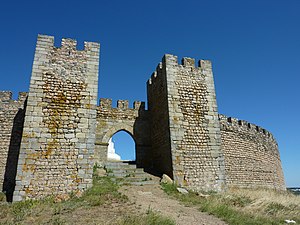
Arraiolos received its first town charter in 1290 , according to other sources in 1310 . King D Dinis had a castle built here from 1305 . After his merits in the Portuguese Revolution in 1383 , Nuno Álvares Pereira received the area from 1387 and he lived in Arraiolos for some time.
Moors expelled from Lisbon settled here in the 15th century and established the tradition of colorful wool carpets for which the place is known to this day. King D. Manuel I renewed Arraiolo's town charter in 1511 as part of his administrative reforms.
The district of Arraiolos was incorporated into the Évora district in 1835 . In 1855 , the district was dissolved and incorporated into the Vimieiro district . From 1895 to 1898 Arraiolos belonged to the district of Mora, only to be independent again since then.

Azulejos in the Igreja da Misericórdia
|
Culture and sights
After their expulsion from the Mouraria district of Lisbon , the Moors , who were well-liked here, stayed in the village and continued their craft of wool carpets . The place is known to this day for the quality carpets.
The place is located directly on the railway line from Évora to Mora, the Ramal de Mora, opened in 1908 . It was closed in 1988 and has now been converted into an Ecovia ( cycle path ).
The megalithic complex (port .: Anta ) Anta de Arraiolos is over 5000 years old. Other archaeological sites are the Roman excavations from the 2nd to 3rd centuries at the Santana Church, and the medieval castle Castelo de Arraiolos from the 14th century. This goes back to about 2500 BC. Bronze Age village built around 1000 BC and around 1000 BC. Built fortification of the Castro culture back.
The local monuments also include various historical private and public buildings, including the cinema, the post office, the former hospital and the train station. Some sacred buildings are also listed, such as the Mannerist - Baroque Igreja da Misericórdia de Arraiolos from the 16th century.
In addition, the historic town center is a listed building as a whole.
The former monastery Convento Nossa Senhora da Assunção from the 16th century has now been converted into a pousada .
administration
circle
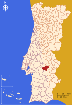
Arraiolos is the seat of a district of the same name. The neighboring districts are (starting clockwise in the north): Mora , Sousel , Estremoz , Évora , Montemor-o-Novo and Coruche .
With the regional reform in September 2013, several municipalities were combined into new municipalities, so that the number of municipalities decreased from seven to five.
The following municipalities ( freguesias ) are in the Arraiolos district:
| local community | Population (2011) |
Area km² |
Density of population / km² |
LAU code |
|---|---|---|---|---|
| Arraiolos | 3,386 | 146.08 | 23 | 070201 |
| Gafanhoeira e Sabugueiro | 890 | 83.40 | 11 | 070208 |
| Igrejinha | 931 | 84.53 | 11 | 070202 |
| São Gregório e Santa Justa | 566 | 117.19 | 5 | 070209 |
| Vimieiro | 1,589 | 252.56 | 6th | 070206 |
| Arraiolos district | 7,362 | 683.76 | 11 | 0702 |
Population development
| Population in Arraiolos County (1801–2011) | |||||||||
|---|---|---|---|---|---|---|---|---|---|
| 1801 | 1849 | 1900 | 1930 | 1960 | 1981 | 1991 | 2001 | 2011 | |
| 3,887 | 4,053 | 8,738 | 11,260 | 12,786 | 9,000 | 8,040 | 8,000 | 7,363 | |
Municipal holiday
traffic
Since the closure of the Ramal de Mora railway line in 1988, the place has no connection to the country's rail network. It is integrated in the national bus network of Rede Expressos .
Arraiolos is connected to junction no. 4 ( Montemor-o-Novo -Este ) of the A6 motorway (here also European route 90 ), 20 km to the south-west, via the N4 national road .
sons and daughters of the town
- Joaquim Heliodoro da Cunha Rivara (1809–1879), doctor, university professor, India researcher and politician
- José Caeiro da Mata (1877–1963), Foreign Minister
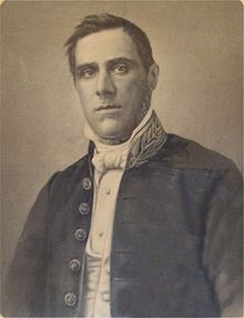
- Máximo Homem de Campos Rodrigues (1879–1927), doctor and politician, head of government of the Évora district
- Simão César Dórdio Gomes (1890–1976), painter
- José Félix Mira (1901–1981), agricultural entrepreneur and politician, head of government of the Évora district
Web links
- Map of the Freguesia Arraiolos at the Instituto Geográfico do Exército
- Official website (Portuguese, Spanish and English)
- Photos from Arraiolos
Individual evidence
- ↑ a b www.ine.pt - indicator resident population by place of residence and sex; Decennial in the database of the Instituto Nacional de Estatística
- ↑ a b Overview of code assignments from Freguesias on epp.eurostat.ec.europa.eu
- ↑ www.ine.pt - indicator resident population by place of residence and sex; Decennial in the database of the Instituto Nacional de Estatística
- ^ João Fonseca: Dicionário do Nome das Terras . 2nd edition, Casa das Letras, Cruz Quebrada 2007, p. 39 ( ISBN 978-9724617305 )
- ^ Lydia Hohenberger, Jürgen Strohmaier: Portugal . 2nd edition, DuMont Reiseverlag, Ostfildern 2009, page 317
- ↑ History ( Memento from 20141021164347), accessed on July 13, 2013
- ↑ www.verportugal.net , accessed on July 13, 2013
- ↑ www.monumentos.pt , accessed on July 13, 2013
- ↑ Thomas G. Schattner (ed.): Archaeological guide through Portugal (= cultural history of the ancient world . Vol. 74). Philipp von Zabern, Mainz 1998, ISBN 3-8053-2313-1 p. 161
- ↑ ditto
- ↑ ditto
- ↑ ditto
- ↑ ditto , accessed on July 13, 2013
- ^ Publication of the administrative reorganization in the Diário da República gazette of January 28, 2013, accessed on March 16, 2014


