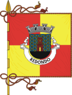
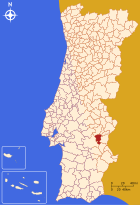
Redondo
| Redondo | ||||||
|---|---|---|---|---|---|---|
|
||||||
| Basic data | ||||||
| Region : | Alentejo | |||||
| Sub-region : | Alentejo Central | |||||
| District : | Évora | |||||
| Concelho : | Redondo | |||||
| Coordinates : | 38 ° 39 ′ N , 7 ° 33 ′ W | |||||
| Residents: | 5733 (as of June 30, 2011) | |||||
| Surface: | 307.8 km² (as of January 1, 2010) | |||||
| Population density : | 19 inhabitants per km² | |||||
| politics | ||||||
| Mayor : | Antonio Carriço | |||||
| Address of the municipal administration: | Junta de Freguesia de Redondo Rua do Calvário nº6 7170-013 Redondo |
|||||
| Website: | www.freg-redondo.pt | |||||
| Redondo county | ||||||
|
||||||
| Residents: | 7031 (as of June 30, 2011) | |||||
| Surface: | 369.51 km² (as of January 1, 2010) | |||||
| Population density : | 19 inhabitants per km² | |||||
| Number of municipalities : | 2 | |||||
| administration | ||||||
| Administration address: | Câmara Municipal de Redondo Praça da República 7170-011 Redondo |
|||||
| President of the Câmara Municipal: | Alfredo Falamino Barroso (MICRE Citizens List) | |||||
| Website: | www.cm-redondo.pt | |||||
Redondo is a small town ( Vila ) and a district ( Concelho ) in Portugal with 5733 inhabitants (as of June 30, 2011).
history
The Anta da Candieira and other megalithic systems show prehistoric settlement at least since the Neolithic . Finds from the 3rd and 2nd centuries BC BC also show a continued settlement up to the Romans .
It is possible that today's place was re-established as part of the settlement policy after the Reconquista . The town charter of King Alfonso III. from the year 1250 can be interpreted in this way. The town charter was confirmed in 1318 and renewed in 1517 as part of the administrative reforms of King Manuel I.
administration
circle
 Redondo is the seat of a district of the same name ( concelho ). The neighboring districts are (starting clockwise in the north): Estremoz , Borba , Vila Viçosa , Alandroal , Reguengos de Monsaraz and Évora .
Two communities ( Freguesias ) are in the Redondo district:
| local community | Population (2011) |
Area km² |
Density of population / km² |
LAU code |
|---|---|---|---|---|
| Montoito | 1,298 | 61.71 | 21st | 071001 |
| Redondo | 5,733 | 307.80 | 19th | 071002 |
| Redondo county | 7,031 | 369.51 | 19th | 0710 |
Population development
| Population in Redondo County (1801–2011) | |||||||||
|---|---|---|---|---|---|---|---|---|---|
| 1801 | 1849 | 1900 | 1930 | 1960 | 1981 | 1991 | 2001 | 2011 | |
| 4 189 | 4,991 | 7 915 | 10 107 | 11 967 | 8 444 | 7 948 | 7 036 | 7 031 | |
Municipal holiday
- Easter Monday
Town twinning
sons and daughters of the town
- João Anastácio Rosa (1812–1884), actor and sculptor
- Hernâni Cidade (1887–1975), Romanist and Lusitanist
- Vitorino Salomé (* 1942), songwriter, composer and singer
- Janita Salomé (* 1947), songwriter and singer, brother of Vitorino Salomé
Web links
- Map of the Freguesia Redondo at the Instituto Geográfico do Exército
- Official website
Individual evidence
- ↑ a b www.ine.pt - indicator resident population by place of residence and sex; Decennial in the database of the Instituto Nacional de Estatística
- ↑ a b Overview of code assignments from Freguesias on epp.eurostat.ec.europa.eu
- ↑ www.ine.pt - indicator resident population by place of residence and sex; Decennial in the database of the Instituto Nacional de Estatística
- ↑ History on the Kreis website ( Memento of the original from November 4, 2008 in the Internet Archive ) Info: The archive link was inserted automatically and has not yet been checked. Please check the original and archive link according to the instructions and then remove this notice. , accessed on August 31, 2013
- ↑ www.anmp.pt , accessed on August 31, 2013


