Mora (Portugal)
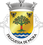
| Mora | ||||||
|---|---|---|---|---|---|---|
|
||||||
| Basic data | ||||||
| Region : | Alentejo | |||||
| Sub-region : | Alto Alentejo | |||||
| District : | Évora | |||||
| Concelho : | Mora | |||||
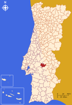
| Coordinates : | 38 ° 57 ′ N , 8 ° 10 ′ W | |||||
| Residents: | 2522 (as of June 30, 2011) | |||||
| Surface: | 127.7 km² (as of January 1, 2010) | |||||
| Population density : | 20 inhabitants per km² | |||||
| Mora County | ||||||
|
||||||
| Residents: | 4978 (as of June 30, 2011) | |||||
| Surface: | 443.96 km² (as of January 1, 2010) | |||||
| Population density : | 11 inhabitants per km² | |||||
| Number of municipalities : | 4th | |||||
| administration | ||||||
| Administration address: | Câmara Municipal de Mora Rua do Município 7490-243 Mora |
|||||
| President of the Câmara Municipal: | Dipl. Ing.Luís Simão de Matos ( CDU ) | |||||
| Website: | www.cm-mora.pt | |||||
Mora is a small town ( Vila ) and a district ( Concelho ) in Portugal with 2522 inhabitants (as of June 30, 2011).
history
After the Reconquista in Portugal, the Portuguese branch of the Order of Calatrava , later the Order of Avis , received the area for settlement in 1211 . Mora was in 1519 the first town charter by King Manuel I. The Anta 1 da Herdade da Ordem is located in the district of Mora.
administration
circle
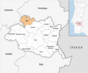
 Mora is the administrative seat of a district of the same name. The neighboring areas are (starting clockwise in the north): Ponte de Sor , Avis , Sousel , Arraiolos and Coruche .
The following municipalities ( Freguesias ) are in the Mora district:
| local community | Population (2011) |
Area km² |
Density of population / km² |
LAU code |
|---|---|---|---|---|
| Brotas | 451 | 83.21 | 5 | 070701 |
| Cabeção | 1,073 | 47.43 | 23 | 070702 |
| Mora | 2,522 | 127.70 | 20th | 070703 |
| Pavia | 932 | 185.62 | 5 | 070704 |
| Mora County | 4,978 | 443.96 | 11 | 0707 |
growth of population
| Population in Mora County (1801–2011) | |||||||||
|---|---|---|---|---|---|---|---|---|---|
| 1801 | 1849 | 1900 | 1930 | 1960 | 1981 | 1991 | 2001 | 2011 | |
| 735 | 2,834 | 5 425 | 8 530 | 10 276 | 7 056 | 6 588 | 5 788 | 4,978 | |
Municipal holiday
- Easter Monday
traffic
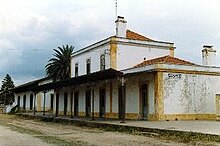
Until the line was closed in 1988, the place was connected to the country's rail network via the Ramal de Mora railway line . Cycle paths have now been laid out on the former railway lines .
The national road N2 leads from Mora about 40 km south to the A6 motorway at Montemor-o-Novo . The N251 national road, which also passes through Mora, connects the town with Vimieiro, about 35 km to the east, and Coruche , about 40 km to the west, both of which are on the N4.
sons and daughters of the town
- Manuel Ribeiro de Pavia (1910–1957), neo-realistic painter and illustrator
- João Paciência (* 1943), architect
- José Croca (* 1944), university professor, quantum physicist
- José Vultos Sequeira (* 1945), writer
Web links
- Map of the Freguesia Mora (Portugal) at the Instituto Geográfico do Exército
- Official website
Individual evidence
- ↑ a b www.ine.pt - indicator resident population by place of residence and sex; Decennial in the database of the Instituto Nacional de Estatística
- ↑ a b Overview of code assignments from Freguesias on epp.eurostat.ec.europa.eu
- ↑ www.ine.pt - indicator resident population by place of residence and sex; Decennial in the database of the Instituto Nacional de Estatística
- ↑ www.verportugal.net , accessed on August 24, 2013
