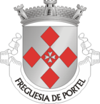
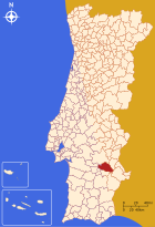
Portel (Portugal)
| Portel | ||||||
|---|---|---|---|---|---|---|
|
||||||
| Basic data | ||||||
| Region : | Alentejo | |||||
| Sub-region : | Alentejo Central | |||||
| District : | Évora | |||||
| Concelho : | Portel | |||||
| Coordinates : | 38 ° 18 ′ N , 7 ° 42 ′ W | |||||
| Residents: | 2661 (as of June 30, 2011) | |||||
| Surface: | 156.44 km² (as of January 1, 2010) | |||||
| Population density : | 17 inhabitants per km² | |||||
| Portel district | ||||||
|
||||||
| Residents: | 6428 (as of June 30, 2011) | |||||
| Surface: | 601 km² (as of January 1, 2010) | |||||
| Population density : | 11 inhabitants per km² | |||||
| Number of municipalities : | 6th | |||||
| administration | ||||||
| Administration address: | Câmara Municipal de Portel Praça D. Nuno Alvares Pereira, 4 7220 - 375 Portel |
|||||
| President of the Câmara Municipal: | Norberto António Lopes Patinho ( PS ) | |||||
| Website: | www.cm-portel.pt | |||||
Portel is a small town ( Vila ) and a district ( Concelho ) in Portugal with 2661 inhabitants (as of June 30, 2011).
history
Human settlement in the area around Portel goes back to the Bronze Age . This is evidenced by megalithic monuments left behind and the Portel's golden ring, which came from a treasure trove.
At the excavations of Mosteiros one of the few finds of buildings of the Visigoth Empire from the early 7th century can be seen. The place also existed under Moorish rule from 704 . After the Reconquista , Portel Castle was built under the Portuguese King Dinis (1279-1325). Then the royal house of Bragança took over the castle and rule over the place. In the years 1509 to 1520 the construction of the castle was then renewed by the architect Francisco de Arruda , who worked for the Duque de Bragança.
administration
circle
 Portel is the seat of a district of the same name. The neighboring districts are (starting clockwise in the north): Évora , Reguengos de Monsaraz , Moura , Vidigueira , Cuba and Viana do Alentejo .
With the regional reform in September 2013 , several municipalities were merged into new municipalities, so that the number of municipalities decreased from eight to six.
The following municipalities ( Freguesias ) are in the Portel district:
| local community | Population (2011) |
Area km² |
Density of population / km² |
LAU code |
|---|---|---|---|---|
| Amieira e Alqueva | 691 | 177.14 | 4th | 070909 |
| Monte do Trigo | 1,240 | 107.11 | 12 | 070903 |
| Portel | 2,661 | 156.44 | 17th | 070905 |
| Santana | 542 | 41.95 | 13 | 070906 |
| São Bartolomeu do Outeiro e Oriola | 836 | 73.74 | 11 | 070910 |
| Vera Cruz | 458 | 44.62 | 10 | 070908 |
| Portel County (Portugal) | 6,428 | 601.00 | 11 | 0709 |
Population development
| Population in the Portel district (1801–2011) | |||||||||
|---|---|---|---|---|---|---|---|---|---|
| 1801 | 1849 | 1900 | 1930 | 1960 | 1981 | 1991 | 2001 | 2011 | |
| 4,698 | 5,673 | 8,095 | 10,491 | 11,627 | 8,306 | 7,525 | 7.109 | 6,428 | |
Web links
- Map of the Freguesia Portel (Portugal) at the Instituto Geográfico do Exército
- Official website
Individual evidence
- ↑ www.ine.pt - indicator resident population by place of residence and sex; Decennial in the database of the Instituto Nacional de Estatística
- ↑ a b Overview of code assignments from Freguesias on epp.eurostat.ec.europa.eu
- ↑ www.ine.pt - indicator resident population by place of residence and sex; Decennial in the database of the Instituto Nacional de Estatística
- ^ Publication of the administrative reorganization in the Diário da República gazette of January 28, 2013, accessed on March 16, 2014


