Moura
| Moura | ||||||
|---|---|---|---|---|---|---|
|
||||||
| Basic data | ||||||
| Region : | Alentejo | |||||
| Sub-region : | Baixo Alentejo | |||||
| District : | Be yes | |||||
| Concelho : | Moura | |||||
| Coordinates : | 38 ° 8 ′ N , 7 ° 27 ′ W | |||||
| Residents: | 15,167 (as of June 30, 2011) | |||||
| Surface: | 958.46 km² (as of January 1, 2010) | |||||
| Population density : | 16 inhabitants per km² | |||||
| Postal code : | 7860 | |||||
| Moura county | ||||||
|
||||||
| Residents: | 15,167 (as of June 30, 2011) | |||||
| Surface: | 958.46 km² (as of January 1, 2010) | |||||
| Population density : | 16 inhabitants per km² | |||||
| Number of municipalities : | 5 | |||||
| administration | ||||||
| Administration address: | Câmara Municipal de Moura Praça Sacadura Cabral 7860-207 Moura |
|||||
| President of the Câmara Municipal: | José Maria Prazeres Pós-de-Mina ( CDU ) | |||||
| Website: | www.cm-moura.pt | |||||
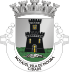
Moura [ ˈmoɾɐ ] ("the Moorish [virgin]" or simply "the Maurin" - see coat of arms) is a city in southeastern Portugal .
Legend
The city's coat of arms symbolizes the legend that goes back to the time of the Portuguese conquest of the former Moorish city. The Mauress Salúquia , daughter of the Moorish ruler of the city called Al'Maniha at the time , was to marry Bráfama, son of the Moorish ruler of the nearby city of Awrûs (today Aroche in the Spanish province of Huelva / Latin Arucci vetus ). Portuguese crusaders , however, intercepted the wedding party, killed the groom, and marched outside the city dressed as Muslims. From the tower awaiting the arrival of her bridegroom, Salúquia took the disguised for the wedding guests and bade the gates open. As soon as the Crusaders began to slaughter the Moors, however, Salúquia realized that her bridegroom had long since been killed. Then she threw herself from the tower to her death, shown in the coat of arms.
history
Moura was granted city status in 1988.
In the area of the district of Moura there are a number of historical buildings, some of which go back to the Roman Empire , when Moura Arucci or Nova Civitas Aruccitana was called. The influence of the Moors on the city as the central location of the then homonymous province of Al'Manijah , as well as that of the early Middle Ages, is significant . The castle of Moura ( Castelo de Moura ) should be mentioned as a special building of Moorish origin, which was expanded as a medieval castle in the period from 1296 to 1315.
In the city of Moura and in the district, a large number of historical buildings, churches and ruins can still be visited today (see sights).
administration
circle
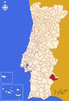
Bordering Spain in the southeast , Moura is the seat of a district of the same name ( concelho ) . The neighboring districts are (starting from the north clockwise): Mourão , Barrancos , Serpa , Vidigueira , Portel and Reguengos de Monsaraz .
With the regional reform in September 2013, several municipalities were merged into new municipalities, so that the number of municipalities decreased from eight to six.
The following municipalities ( freguesias ) are in the district of Moura, the first three together forming the city of Moura:
| local community | Population (2011) |
Area km² |
Density of population / km² |
LAU code |
|---|---|---|---|---|
| Amareleja | 2,564 | 108.56 | 24 | 021001 |
| Póvoa de São Miguel | 888 | 187.08 | 5 | 021002 |
| Moura (Santo Agostinho e São João Baptista) e Santo Amador | 8,831 | 287.42 | 31 | 021009 |
| Safara e Santo Aleixo da Restauração | 1,871 | 237.20 | 8th | 021010 |
| Sobral da Adiça | 1,013 | 138.20 | 7th | 021008 |
| Moura county | 15,167 | 958.46 | 16 | 0210 |
Population development
| Population in Moura County (1801–2011) | |||||||||
|---|---|---|---|---|---|---|---|---|---|
| 1801 | 1849 | 1900 | 1930 | 1960 | 1981 | 1991 | 2001 | 2011 | |
| 10,283 | 13,130 | 17,417 | 23,753 | 29,106 | 19,772 | 17,549 | 16,590 | 15,167 | |
Municipal holiday
- June 24th
Town twinning
-
 Spain : Aroche , Huelva Province (since 1994)
 -
 Tunisia : Medjez el-Bab (since 1995)
 -
 Guinea-Bissau : Bissau (since 1997)
 -
 Italy : Roccagorga (Cooperation Agreement)
Attractions
- In the district (concelho) of Moura
| description | category | Type | Municipality / ( Freguesia ) |
|---|---|---|---|
| [1] Castro da Azougada from the 6th to 4th century BC. | archeology | Excavation , fortified settlement | São João Baptista |
| [2] São João Baptista Church or Mother Church of Moura | Religious building | church | City of Moura |
| [3] Parish Church of Santo Aleixo da Restauração | Religious building | church | Santo Aleixo da Restauração |
| [4] Parish Church of Safara | Religious building | church | Safara |
| [5] São Francisco Church and Convent São Francisco | Religious building | Church, monastery | City of Moura |
| [6] “Roman” bridge from the time of the Restoration War (1580–1640) over the Brenhas River | Military structure | bridge | Outskirts of Moura |
| [7] Castelo de Moura - castle, church and abandoned Dominican convent | Military structure | Castle , monastery, ruins | City of Moura |
| [8] Quarters of Moura from the time of the Restoration War | Civil architecture | Buildings as soldiers' quarters | City of Moura |
| [9] São Pedro Church or Municipal Museum of Ecclesiastical Art in Moura | Religious building | former church, museum | City of Moura |
| [10] Convento do Carmo - oldest Carmelite church and Carmelite monastery on the Iberian Peninsula (1250) | Religious building | Church, former monastery | City of Moura |
| [11] Mouraria de Moura - settlement area of the Arab population after the Reconquista | architecture | Settlement district | City of Moura |
| [12] Galeria dolménica and Anta na Herdade da Negrita or Pedra das Antas and Anta das Pedras Tanchadas | archeology | Megalithic monuments | Santo Aleixo da Restauração |
| [13] Atalaia Magra or Atalaia da Cabeça Magra - defense tower against Castile from the 13th century. | Military structure | Tower , ruin | Santo Agostinho |
| [14] Lagar de Varas de Fojo - Olive oil mill from the 19th century in operation until 1941 | architecture | Oil mill , museum | City of Moura |
| [15] Church of Nossa Senhora da Estrela | Religious building | church | Póvoa de São Miguel |
| [16] Castro dos Ratinhos or Outeiro dos Castelos - settlement probably from the Iron Age | archeology | Excavation, fortified settlement | Outskirts of Moura |
sons and daughters of the town
- Inocêncio Camacho Rodrigues (1867–1943), bank manager and politician
- Mário Corino de Andrade (1906-2005), neurologist
- Eunice Muñoz (born 1928), actress
- Miguel Garcia (born 1983), football player
Web links
Individual evidence
- ↑ a b www.ine.pt - indicator resident population by place of residence and sex; Decennial in the database of the Instituto Nacional de Estatística
- ↑ a b Overview of code assignments from Freguesias on epp.eurostat.ec.europa.eu
- ↑ http://www.portaldemoura.com/index.php?option=com_content&task=view&id=1357&Itemid=1
- ^ Publication of the administrative reorganization in the Diário da República gazette of January 28, 2013, accessed on March 16, 2014
- ↑ www.anmp.pt , accessed on January 4, 2012


