Aljustrel
| Aljustrel | ||||||
|---|---|---|---|---|---|---|
|
||||||
| Basic data | ||||||
| Region : | Alentejo | |||||
| Sub-region : | Baixo Alentejo | |||||
| District : | Be yes | |||||
| Concelho : | Aljustrel | |||||
| Coordinates : | 37 ° 55 ′ N , 8 ° 10 ′ W | |||||
| Residents: | 5127 (as of June 30, 2011) | |||||
| Surface: | 191.3 km² (as of January 1, 2010) | |||||
| Population density : | 27 inhabitants per km² | |||||
| politics | ||||||
| Address of the municipal administration: | Junta de Freguesia de Aljustrel Av. 1º de Maio 7600 - 010 Aljustrel |
|||||
| Website: | mun-aljustrel.pt | |||||
| District of Aljustrel | ||||||
|
||||||
| Residents: | 9257 (as of June 30, 2011) | |||||
| Surface: | 458.48 km² (as of January 1, 2010) | |||||
| Population density : | 20 inhabitants per km² | |||||
| Number of municipalities : | 4th | |||||
| administration | ||||||
| Administration address: | Câmara Municipal de Aljustrel Av. 1º May 7600-010 Aljustrel |
|||||
| President of the Câmara Municipal: | Nelson Domingos Brito ( PS ) | |||||
| Website: | www.mun-aljustrel.pt | |||||
Aljustrel is a small town ( Vila ) and a district ( Concelho ) in Portugal with 5127 inhabitants (as of June 30, 2011).
history
Aljustrel is a historical place in the Alentejo . It was called Vipasca in the time of the Romans and later Al-luster under the Moors , from which the current name can be derived. The ruins of the castle, which were placed under monument protection in 1992, date from this time. In 1234 Aljustrel was recaptured under King D. Sancho II, by D. Paio Peres Correia and the Knights of the Order of Santiago , and so it happens that Aljustrel is first mentioned in writings as early as 1252 and received town charter on September 20, 1510 .
The following centuries were marked by the mining of mines, which also affected other places in this region, as Aljustrel belongs to the pyrite belt of the South Iberian peninsula . It is no longer clear today when mining began in Aljustrel, but there are many indications that this was already 3000 years BC. Happened. Under the Romans it was mainly copper that was mined here until 400 AD. Industrial dismantling began in 1849 and shafts, buildings and remains of construction from that time can still be seen in a large area.
The main church of São Salvador, which was built in the 15th century and where the 2 meter thick walls are particularly noticeable, belongs to the historical heritage of the place. In the interior there is a tile painting ( azulejos ) from the 17th century which was made by Gabriel del Barco.
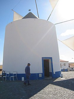
There are 15 windmills in the district, which are gradually being restored.
economy
Lundin Mining Corporation has owned Minas de Aljustrel since 2004 . In response to the rapid fall in zinc prices on the world market, production of zinc was stopped in November 2008, although the mine only started operations again in May 2008 with EU subsidies. The further fate of the mine is still uncertain. There was a separate railway connection, the Ramal de Aljustrel, for the transport of minerals from this mine .
administration
circle
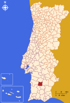
Aljustrel is the administrative seat of a district of the same name ( concelho ) in the Beja district . The neighboring areas are (starting clockwise in the north): Ferreira do Alentejo , Beja , Castro Verde , Ourique and Santiago do Cacém .
With the territorial reform in September 2013, the municipalities of Aljustrel and Rio de Moinhos were combined to form the new municipality of União das Freguesias de Aljustrel e Rio de Moinhos , so that the number of municipalities decreased from five to four.
The following municipalities ( Freguesias ) are in the Aljustrel district:
| local community | Population (2011) |
Area km² |
Density of population / km² |
LAU code |
|---|---|---|---|---|
| Aljustrel e Rio de Moinhos | 5,878 | 228.84 | 26th | 020106 |
| Ervidel | 1.005 | 38.85 | 26th | 020102 |
| Messejana | 892 | 113.77 | 8th | 020103 |
| Sao João de Negrilhos | 1,482 | 77.02 | 19th | 020104 |
| District of Aljustrel | 9,257 | 458.48 | 20th | 0201 |
Population development
| Population in the district of Aljustrel (1801–2011) | |||||||||
|---|---|---|---|---|---|---|---|---|---|
| 1801 | 1849 | 1900 | 1930 | 1960 | 1981 | 1991 | 2001 | 2011 | |
| 1,878 | 4,278 | 8.214 | 15,276 | 18,181 | 12,870 | 11,990 | 10,567 | 9.234 | |
Municipal holiday
- June 13th
Town twinning
-
 France : Hem , Nord department
sons and daughters of the town
- António Aboim Inglês (1860–1941), politician, Republican Minister of Agriculture
- Brito Camacho (1862-1934), Republican politician
- António Lobo de Almada Negreiros (1868–1939), journalist, writer and diplomat, worked in particular on São Tomé and Príncipe , father of the artist Almada Negreiros
- Mariano Martins (1880–1943), military and politician, governor of São Tomé and Príncipe and of Portuguese India
Web links
- Map of the Freguesia Aljustrel at the Instituto Geográfico do Exército
- official site of the Cámara Municipal of Aljustrel
- RailFanEurope.net shows pictures of the rail connection from Aljustrel
Individual evidence
- ↑ www.ine.pt - indicator resident population by place of residence and sex; Decennial in the database of the Instituto Nacional de Estatística
- ↑ a b Overview of code assignments from Freguesias on epp.eurostat.ec.europa.eu
- ↑ www.ine.pt - indicator resident population by place of residence and sex; Decennial in the database of the Instituto Nacional de Estatística
- ^ Publication of the administrative reorganization in the Diário da República gazette of January 28, 2013, accessed on March 16, 2014
- ↑ www.anmp.pt , accessed on February 2, 2013


