
Castro Verde
| Castro Verde | ||||||
|---|---|---|---|---|---|---|
|
||||||
| Basic data | ||||||
| Region : | Alentejo | |||||
| Sub-region : | Baixo Alentejo | |||||
| District : | Be yes | |||||
| Concelho : | Castro Verde | |||||
| Freguesia : | União das Freguesias de Castro Verde e Casével | |||||
| Coordinates : | 37 ° 42 ′ N , 8 ° 5 ′ W | |||||
| Castro Verde County | ||||||
|
||||||
| Residents: | 7276 (as of June 30, 2011) | |||||
| Surface: | 569.44 km² (as of January 1, 2010) | |||||
| Population density : | 13 inhabitants per km² | |||||
| Number of municipalities : | 4th | |||||
| administration | ||||||
| Administration address: | Câmara Municipal de Castro Verde Praça do Municipio 7780-217 Castro Verde |
|||||
| President of the Câmara Municipal: | Francisco José Caldeira Duarte ( CDU ) | |||||
| Website: | www.cm-castroverde.pt | |||||


Castro Verde is a small town ( Vila ) and a district ( Concelho ) in Portugal with 4858 inhabitants (as of June 30, 2011).
history
The area around Castro Verde was founded in the 6th century BC. Populated by the Celts , who were already mining pyrite and copper in the area of the Mina de Neves Corvo . The name of the place is passed down with Oppidum, to whose territory the Castros also belonged. Even during the Roman era, Castro Verde was located directly on the transport route for the metals and pyrite that was extracted in the mines in the area. Visigoths and later the Moors also lived in Castro Verde until the reconquest ( Reconquista ) by the Christians in the nearby battlefield of Ourique around 1143, the founding of Portugal was sealed by the Treaty of Zamora. The Royal Basilica of Castro Verde, completed under King Sebastian in 1573, was built in memory of this battle. The painted tiles ( azulejos ) still show scenes of the battle in memory. In the period from the 14th to the 16th century, the area around Castro Verde became Portugal's granary. This process was intensified by King D. Dinis.

Castro Verde received town charter in 1510 .
administration
circle
Castro Verde is the administrative seat of a district of the same name. The neighboring regions are (starting clockwise in the north): Aljustrel , Beja , Mértola , Almodôvar and Ourique .
With the territorial reform in September 2013 , the municipalities ( freguesias ) Castro Verde (municipality) and Casével were combined to form the new municipality União das Freguesias de Castro Verde e Casével . Since then, the district has consisted of the following four municipalities:

| local community | Population (2011) |
Area km² |
Density of population / km² |
LAU code |
|---|---|---|---|---|
| Castro Verde e Casével | 5,346 | 322.77 | 17th | 020606 |
| Entradas | 649 | 76.23 | 9 | 020603 |
| Santa Bárbara de Padrões | 943 | 66.31 | 14th | 020604 |
| São Marcos da Ataboeira | 338 | 104.13 | 3 | 020605 |
| Castro Verde County | 7,276 | 569.44 | 13 | 0206 |
Population development
| Population in Castro Verde County (1801–2011) | ||||||||
|---|---|---|---|---|---|---|---|---|
| 1801 | 1849 | 1900 | 1930 | 1960 | 1981 | 1991 | 2001 | 2011 |
| 2027 | 5930 | 7712 | 11,032 | 11,637 | 7472 | 7762 | 7603 | 7276 |
Municipal holiday
- June 29th

sons and daughters of the town
- Alfredo Luís da Costa (1883–1908), publicist and sales representative, Freemason, implicated in the murder of King D. Carlos
- António Gonçalves Correia (1886–1967), anarchist journalist and writer
- Raquel Maria (1946–2006), actress
- Frederico Rosa (* 1957), soccer player, national player at the 1986 World Cup
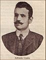
Alfredo Luís da Costa

António Gonçalves Correia


Web links
- Map of the Freguesia Castro Verde at the Instituto Geográfico do Exército
- Official website
Individual evidence
- ↑ www.ine.pt - indicator resident population by place of residence and sex; Decennial in the database of the Instituto Nacional de Estatística
- ↑ Overview of code assignments from Freguesias on epp.eurostat.ec.europa.eu
- ^ Publication of the administrative reorganization in the Diário da República gazette of January 28, 2013, accessed on March 16, 2014

Aljustrel | Almodôvar | Alvito | Barrancos | Beja | Castro Verde | Cuba | Ferreira do Alentejo | Mértola | Moura | Odemira | Ourique | Serpa | Vidigueira