Abomination (Remscheid)
|
Horror
City of Remscheid
Coordinates: 51 ° 10 ′ 44 ″ N , 7 ° 14 ′ 57 ″ E
|
||
|---|---|---|
| Height : | 339 m above sea level NN | |
|
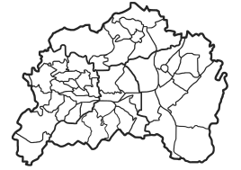
Location of Greuel in Remscheid |
||
Greuel is a residential area in the southeast of the Bergisch city of Remscheid in North Rhine-Westphalia .
Location and description
Greuel is located in the statistical district Grenzwall of the urban district Lennep on today's Tenter Weg south of the federal road 229 and the Lennep core town. Other neighboring towns are the residential areas and farms Trecknase , Am Grenzwall , Neuenweg , Jägerhaus , Lehmkuhle , Birgden II and Rotzkotten .
The route of the disused railway line Wuppertal-Oberbarmen-Opladen ("Balkanexpress") leads past the place. In the 1960s, the last residential buildings in the village were demolished to make way for the Tenter Weg industrial park . In place of the settlement core, there are now factory buildings and their access.
history
In 1815/16 32 people lived in the village. In 1832 Greuel was part of the Altbergian rural community of Fünfzehnhöfe , which belonged to the mayor of Wermelskirchen . According to the statistics and topography of the Düsseldorf administrative district , the place called a day laborer's apartment had two residential buildings and two agricultural buildings at that time. At that time, 29 residents lived in the village, two of them Catholic and 27 Protestant.
In the municipality lexicon for the Rhineland province , three houses with 24 inhabitants are given for the year 1885. At that time the place belonged to the mayor's office of Fünfzehnhöfe within the Lennep district . In 1895 the place had three houses with 20 inhabitants, in 1905 four houses and 56 inhabitants. In 1906, the mayor's office was incorporated into the town of Lennep, which in turn was incorporated into Remscheid in 1929.
In the Middle Ages and early modern times, the route of the Cologne – Dortmund army route passed the residential area .
Individual evidence
- ↑ Johann Georg von Viebahn : Statistics and Topography of the Administrative District of Düsseldorf , 1836
- ↑ Königliches Statistisches Bureau (Prussia) (Ed.): Community encyclopedia for the Rhineland Province, based on the materials of the census of December 1, 1885 and other official sources, (Community encyclopedia for the Kingdom of Prussia, Volume XII), Berlin 1888.
- ↑ Königliches Statistisches Bureau (Prussia) (Ed.): Community encyclopedia for the Rhineland Province, based on the materials of the census of December 1, 1895 and other official sources, (Community encyclopedia for the Kingdom of Prussia, Volume XII), Berlin 1897.
- ↑ Königliches Statistisches Bureau (Prussia) (Ed.): Community encyclopedia for the Rhineland Province, based on the materials of the census of December 1, 1905 and other official sources, (Community encyclopedia for the Kingdom of Prussia, Volume XII), Berlin 1909.
