Lehmkuhle (Remscheid)
|
Mud Hollow
City of Remscheid
Coordinates: 51 ° 10 ′ 35 ″ N , 7 ° 15 ′ 18 ″ E
|
||
|---|---|---|
| Height : | 346 m above sea level NN | |
|
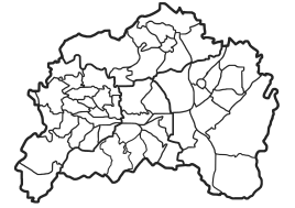
Location of Lehmkuhle in Remscheid |
||
Lehmkuhle is a residential area in the southeast of the Bergisch city of Remscheid in North Rhine-Westphalia .
Location and description
Lehmkuhle is located in the statistical district of Trecknase in the Lennep district on federal road 51 south of Lennep on the watershed between the Wupper (via Lenneper Bach and Feldbach ), the Eschbach and the Morsbach (the latter also in the Wupper river system). Other neighboring towns are the residential areas and courts of Neuenweg , Greuel , Rotzkotten , Leverkusen and Stöcken .
Lehmkuhle consists of several settlement areas on a distance of around 700 m along the federal road, which are marked on the topographical survey of the Rhineland from 1824 and on the Prussian first survey of 1844 as Lehmkuhle and Auf der Lehmkuhle . The route of the disused railway line Wuppertal-Oberbarmen-Opladen ("Balkanexpress") also runs parallel to the main road past the street settlement.
The residential areas on Höhenweg and the Trecknase industrial area have moved closer to the largest and most northerly settlement area of the street settlement , so that this location can no longer be perceived as an independent residential area.
history
In 1815/16 there were 66 people living in the village. In 1832 Lehmkuhle was part of the Altbergian rural community of Fünfzehnhöfe , which belonged to the mayor's office of Wermelskirchen . According to the statistics and topography of the Düsseldorf administrative district , the place called an inn and arable farm had a school, nine residential buildings and eight agricultural buildings at that time. At that time, 79 residents lived in the village, six of them Catholic and 73 Protestant.
In the municipality lexicon for the Rhineland province , 13 houses with 89 inhabitants are given for the year 1885. At that time the place belonged to the mayor's office of Fünfzehnhöfe within the Lennep district . In 1895 the place had twelve houses with 70 inhabitants, in 1905 twelve houses and 68 inhabitants. In 1906 the mayor's office was incorporated into the town of Lennep, which was in turn incorporated into Remscheid in 1929.
In the years 1773–78, past the residential area, the Chaussee from Cologne to Lennep was re-routed, today's federal road 51, which replaced the old Cologne – Dortmund military route between Wermelskirchen and Lennep , an at least early medieval old road . But even before that, the Bergische Eisenstraße , a regionally important transport route for pig iron from the Siegen area, ran through the town in the early modern era . This old street is marked on the topographia as Ÿſer-Stras .
Individual evidence
- ↑ Johann Georg von Viebahn : Statistics and Topography of the Administrative District of Düsseldorf , 1836
- ↑ Königliches Statistisches Bureau (Prussia) (Ed.): Community encyclopedia for the Rhineland Province, based on the materials of the census of December 1, 1885 and other official sources, (Community encyclopedia for the Kingdom of Prussia, Volume XII), Berlin 1888.
- ↑ Königliches Statistisches Bureau (Prussia) (Ed.): Community encyclopedia for the Rhineland Province, based on the materials of the census of December 1, 1895 and other official sources, (Community encyclopedia for the Kingdom of Prussia, Volume XII), Berlin 1897.
- ↑ Königliches Statistisches Bureau (Prussia) (Ed.): Community encyclopedia for the Rhineland Province, based on the materials of the census of December 1, 1905 and other official sources, (Community encyclopedia for the Kingdom of Prussia, Volume XII), Berlin 1909.
- ↑ Erich Philipp Ploennies : Topographia Ducatus Montani (1715) , two volumes consisting of a book, ISBN 3-87707-073-6 and maps, ISBN 3-87707-074-4
- ^ Harry Böseke: Die Bergische Eisenstraße , ISBN 3-923495-71-4
