Gugulethu
| Gugulethu | ||
|---|---|---|
|
|
||
| Coordinates | 33 ° 58 ′ 55 " S , 18 ° 34 ′ 1" E | |
| Basic data | ||
| Country | South Africa | |
| Western cape | ||
| metropolis | City of Cape Town Metropolitan Municipality | |
| ISO 3166-2 | ZA toilet | |
| height | 26 m | |
| surface | 6.5 km² | |
| Residents | 98,468 (2011) | |
| density | 15,172.3 Ew. / km² | |
|
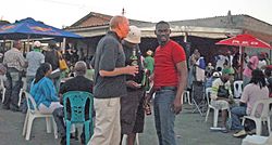
Tourists at Mzoli’s in Gugulethu
|
||
Gugulethu (also: Guguletu ) is one of the southern suburbs of Cape Town in South Africa . During the period of apartheid in South Africa, Gugulethu was built as a township 15 kilometers from Cape Town. It belongs to the City of Cape Town Metropolitan Municipality .
geography
In 2011 the district had 98,468 inhabitants. Most of the inhabitants belong to the Xhosa people ; the predominant language in Gugulethu with 89% is isiXhosa . Gugulethu is in the north of the Cape Flats .
history
Until Gugulethu was built, Langa , twelve kilometers southeast of Cape Town , originally built for 850 people, was Cape Town's only township. Because of the oppressive overpopulation in Langa, two more townships were built east of Cape Town in the Cape Flats in the 1950s and 60s, Nyanga and Gugulethu, which was first called Nyanga West . The name Gugulethu comes from the Xhosa language and is a contraction of the words igugu lethu , which means "our pride". Many black residents of Cape Town, especially from District Six , were then resettled to Gugulethu.
On March 3, 1986, the streets of NY1 and NY111 seven young men were members of the special unit at the intersection Vlakplaas the police shot. The Gugulethu Seven Memorial at the crime scene, built in 2005, is a reminder of this. Seven openwork granite blocks stand here as a symbol for the seven men who came to be known as the Gugulethu Seven .
At the time of apartheid no street names were given in the newly founded townships, but abbreviations and numbering. The main street that runs through Gugulethu was called NY1 (Native Yard 1) but was renamed Steve Biko Drive in 2012 . The other streets will also be gradually renamed.
After apartheid ended in 1994, thousands of rural South Africans came to Gugulethu to find work in Cape Town.
Economy and Transport
Many efforts are being made to improve Gugulethu's infrastructure, to guarantee electricity and water supplies and to promote tourism with overnight accommodation. Restaurants and meeting places such as Mzoli’s and Tiger’s with performance opportunities for musicians developed within Gugulethu .
The N2 trunk road runs along the northern border . Several urban motorways run through Gugulethu, the M9 runs along the southern edge. The Bonteheuwel Line of the Metrorail Western Cape runs close by Gugulethu Nyanga.
Web links
- Mzoli's Meat Blog about Gugulethu (English) and photos
Individual evidence
- ↑ a b 2011 Census , accessed on May 6, 2016
- ↑ Gugulethu Seven Memorial at capetownmagazine.com (English), accessed April 13, 2018
- ↑ BBC article on the television documentary The Guguletu Seven (2001) (English)


