Gummfluh
| Gummfluh | ||
|---|---|---|
|
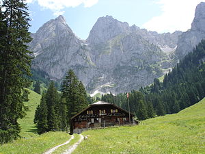
The Gummfluh from the nature reserve La Pierreuse (northwest side) |
||
| height | 2458 m above sea level M. | |
| location | Cantonal border Vaud / Bern , Switzerland | |
| Mountains | Vaudois pre-Alps | |
| Dominance | 7.1 km → La Pare | |
| Notch height | 574 m ↓ Col de Jable | |
| Coordinates | 581 270 / 143279 | |
|
|
||
The Gummfluh is a mountain in the Vaudois Pre-Alps in Switzerland . With a height of 2458 m above sea level. M. it is the highest peak in the mountain range on the south side of the Pays-d'Enhaut district and lies on the border between the cantons of Bern and Vaud . It borders the La Pierreuse nature reserve .

