Gur (Amur)
|
Gur Гур, Хунгари (Chungari) |
||
|
|
||
| Data | ||
| Water code | RU : 20030900112118100072868 | |
| location | Khabarovsk region ( Russia ) | |
| River system | Amur | |
| Drain over | Amur → Tatar Sound | |
| source |
Sichote-Alin 49 ° 37 ′ 6 " N , 139 ° 17 ′ 57" E |
|
| muzzle |
Amur coordinates: 50 ° 6 '3 " N , 136 ° 54' 2" E 50 ° 6 '3 " N , 136 ° 54' 2" E
|
|
| length | 349 km | |
| Catchment area | 11,800 km² | |
| Left tributaries | Dschaur , Chosso , Tschermal | |
| Right tributaries | Verkhnyaya Udomi , Uktur , Nizhnyaya Udomi | |
|
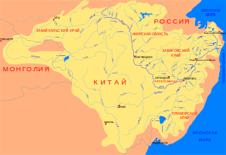
Course of the Gur (Гур) in the catchment area of the Amur |
||
The Gur ( Russian Гур ) is a right tributary of the Amur in the Khabarovsk region in the Far East of Russia .
The river has its source in the Sichote-Alin Mountains. It initially flows in a northerly direction, but then turns to the west and finally flows into the Amur about 50 km south of the city of Komsomolsk am Amur. The Gur has a length of 349 km. Its catchment area covers 11,800 km². Important tributaries of the Gur are Dschaur , Chosso and Tschermal from the left and the Verkhnyaya Udomi , Uktur and Nizhnyaya Udomi from the right.
