
Hölibach (Reuss)
| Hoelibach | ||
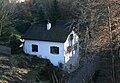
 Hölibach near Gibstorf |
||
| Data | ||
| location | Canton of Aargau , Switzerland | |
| River system | Reuss | |
| Drain over | Reuss → Aare → Rhine → North Sea | |
| source | between Schwabenberg and Petersberg | |
| Source height | approx. 540 m | |
| muzzle | at Gibstorf in the Reuss coordinates: 47 ° 29 '7 " N , 8 ° 14' 18" E ; CH1903: 660 267 / 259 712 47 ° 29 '7 " N , 8 ° 14' 18" O |
|
| Mouth height | approx. 330 m | |
| Height difference | approx. 210 m | |
| Bottom slope | approx. 50 ‰ | |
| length | 4.2 km | |
The Hölibach is a 4 km long stream in the canton of Aargau and a tributary of the Reuss . It drains a large part of the municipality of Gibstorf in the Baden district .
The stream rises east of the village and south of the Chörnlisberg in the Müsere forest and takes in only a few and very short tributaries in its course. In the upcoming Jurassic limestone between the hills Hornebni and Eichhölzli, it has formed an erosion valley running to the northwest, which leads to the settlement center of Gibstorf. The Lochmühle group of houses is in the valley. The place in the narrow cut is also called Höli, and the name of the Hölibach is derived from this designation. It flows from the main road in the village settlement over its wide rubble fan in the former Reussschachen floodplain in the moated castle of Switzerland and flows into the Reuss at Gibstorfer Schächli.
photos

Entry of the Hölibach into the Dole under the main road in Gibstorf
Hole mill

