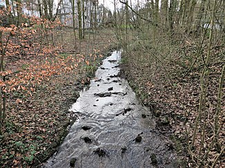
Halden Bach
| Halden Bach | ||
|
Haldener Bach on Wehbergstrasse in Hagen-Halden |
||
| Data | ||
| Water code | DE : 2766998 | |
| location | North Rhine-Westphalia , Germany | |
| River system | Rhine | |
| source |
Hagen , between Feithstr., Flensburg street and road Berchumer 51 ° 22 '4 " N , 7 ° 30' 3" O |
|
| Source height | 177 m above sea level NN | |
| muzzle | In Hagen-Halden in the Lenne coordinates: 51 ° 23 '11 " N , 7 ° 31' 20" E 51 ° 23 '11 " N , 7 ° 31' 20" E |
|
| Mouth height | 103 m above sea level NN | |
| Height difference | 74 m | |
| Bottom slope | 27 ‰ | |
| length | 2.8 km | |
| Catchment area | 1.942 km² | |
| Big cities | Hagen | |
The Haldener Bach is a tributary of the Lenne on the northwestern edge of the Sauerland and in the southern Ruhr area .
Stream
The Haldener Bach rises in the urban area of Hagen northwest of the Eppenhausen University of Applied Sciences at an altitude of 177 m above sea level. NN , the source area is a biotope worthy of protection. On its further course in a north-easterly direction, it crosses the Halden district and opens at 103 m above sea level. NN as a left tributary into the Lenne. The mouth area of the Haldener Baches was renatured in 2006/2007 for the last hundred meters by the city drainage system Hagen, by removing the construction with concrete half-shells and grass pavers and flattening steep areas of the embankment in the base and embankment area; In addition, the bank areas have been planted with trees such as black alder and ash that are appropriate to the location.
Length specifications
Total length of the body of water 2.784 km of
which 1.02 km is cased,
gradient 74 m
Individual evidence
- ↑ a b German basic map of the state of North Rhine-Westphalia 1: 5000
- ↑ a b Topographical Information Management, Cologne District Government, Department GEObasis NRW ( Notes )
- ↑ Project-related development plan Berchumer Str. 64 in Hagen - landscape conservation plan (LBP) August 21, 2015 (accessed September 12, 2016) (PDF)
Web links
- Ölmühlen- and Haldener Bach are renatured July 22, 2006 (accessed September 11, 2016)
