Hall's gap
| Hall's gap | |||||||
|---|---|---|---|---|---|---|---|
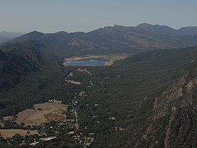
 View of Halls Gap from the Boroka Lookout |
|||||||
|
|||||||
|
|||||||
|
|||||||
|
|||||||
|
|
|||||||
Halls Gap is a location in the Grampians National Park in the Australian state of Victoria . The place has just under 300 inhabitants (as of 2016), but is a tourist center for the Grampians. After the Great Ocean Road , Halls Gap is the second highest number of day-trippers in Victoria.
Geographical location
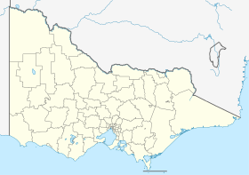
Halls Gap is located around 250 km west of Melbourne , in the Fyans Valley on the narrow northern passage between the Mount William mountain range, which closes the Grampians to the east, and the Wonderland mountain range in the central part of the Grampians. In Halls Gap, Mount Victory Road branches off to the northwest in the direction of Horsham from Grampians Road , which runs through the Grampians lengthways as part of the connection from the coast to the interior of Victoria. This fact makes Halls Gap a local traffic junction in the extensive road network of the region.
History
The original inhabitants, Aborigines from the Tjapwurong tribe , called the place Mokepili .
The first European settler on the site was Charles Browning Hall . In 1841 he was looking for grazing land for his cattle after he discovered that there was an oversupply at the cattle market in Port Phillip . Following the paths of the Aborigines, he finally reached the relatively water-rich place.
Tourism and sightseeing
accommodation
Halls Gap and the immediate vicinity offer a wide range of accommodation options in hotels and hostels - a total of around 6,000 beds. The ecologically managed, architecturally remarkable youth hostel has received multiple awards. There is a campsite in the middle of the village.
Catering
There are several restaurants, pubs and cafes, a supermarket and a gas station in the village.
Culture
South of the town entrance the Brambuk National Park & Cultural Center gives a comprehensive impression of the culture and the history of the Aborigines of the region.
Behind the cultural center, the Gariwerd Dreaming Theater presents music and tells stories from and about the dream time , the time before the European immigrants took over Australia. The theater also shows films about the history and culture of the original inhabitants of the region.
Natural monuments
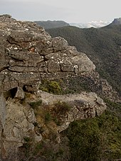
The surrounding mountain ranges with their forests, their bizarre sandstone formations and their rich flora and fauna are a popular hiking area. Numerous steep walls and overhangs attract climbers.
Some of the most famous excursion destinations of the Grampians are within a few kilometers of Halls Gap:
- The water reservoir of Lake Bellfield with its sandy beaches.
- The Pinnacle , Reeds Lookout , Balconies and Boroka Lookout viewpoints . Reeds Lookout and Boroka Lookout can be reached directly by car. The balconies can be reached via a comfortable footpath within 15 minutes from the parking lot at Reeds Lookout . For the scenic ascent and descent to the Pinnacle , from the Wonderland Car Park parking lot , depending on your constitution and the route you choose, you should allow 3½ to 5 hours.
- A 30-minute walk from the center of the village leads through a shady, park-like valley to the Venus Baths , a natural bath formed by a group of pools in a rocky creek bed.
Web links
Individual evidence
- ↑ a b Australian Bureau of Statistics : Halls Gap (L) ( English ) In: 2016 Census QuickStats . June 27, 2017. Retrieved April 18, 2020.


