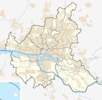
Hammerbrook lock
| Hammerbrook lock | ||
|---|---|---|
|
The Hammerbrook lock |
||
| location | ||
|
|
||
| Coordinates | 53 ° 32 '40 " N , 10 ° 0' 47" E | |
| Country: | Germany | |
| Place: | Hamburg | |
| Waters: | Northern Elbe | |
| Data | ||
| Start of planning: | 1844 | |
| Start of operation: | 1847 | |
| Modification: | 1865/66 | |
| lock | ||
| Others | ||
The Hammerbrook lock is a technical structure in the port of Hamburg . The lock is a listed building.
description
The lock is located in the Oberhafen in Hamburg-Hammerbrook . As a weir it serves to regulate the tide of the lock canal that branches off from the Norderelbe at this point . The lock chamber, the original gates of which have not been preserved, is partly part of the city dike. The eastern extension of the building has a centrally mounted revolving gate with two hinged gates in the two lower corners that were used to regulate the water level.
history
The lock was built from 1844 to 1847 according to plans by Johann Hermann Maack and expanded in 1865/66. It was created in the course of the Hammerbrook development.
From 2008 to 2009 the lock was revised. The steel components were given new corrosion protection ; the segment gate on the Elbe side was raised to 7.90 meters above sea level , the inside mortise gate and the lock chamber to 7.60 meters above sea level.
Web links
Individual evidence
- ↑ a b Ralf Lange : Architecture in Hamburg - The great architecture guide . 1st edition. Junius Verlag, Hamburg 2008, ISBN 978-3-88506-586-9 , p. 148-149 .
- ↑ Measures to improve flood protection systems (pdf) Information from the City of Hamburg on flood protection measures in 2009. Accessed on December 28, 2014.

