Hammond Glacier
| Hammond Glacier | ||
|---|---|---|
|
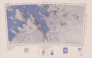
Boyd Glacier map sheet from 1969, Hammond Glacier in the center of the map |
||
| location | Marie Byrd Land , West Antarctica | |
| Mountains | Ford Ranges | |
| length | 65 km | |
| Coordinates | 77 ° 25 ′ S , 146 ° 0 ′ W | |
|
|
||
| drainage | Sulzberger Ice Shelf | |
The Hammond Glacier is a 65 km long glacier on the Saunders coast of Marie Byrd Land in western Antarctica . In the Ford Ranges it flows on the northeast flank of the Haines Mountains in a northwest direction to the Sulzberger Ice Shelf .
Participants in the second Antarctic expedition (1933-1935) of the US polar explorer Richard Evelyn Byrd discovered him in 1934. Byrd named him after the mining engineer and philanthropist John Hays Hammond (1855-1936).
Web links
- Hammond Glacier in the Geographic Names Information System of the United States Geological Survey (English)
- Hammond Glacier on geographic.org (English)

