Harris Peninsula
| Harris Peninsula | ||
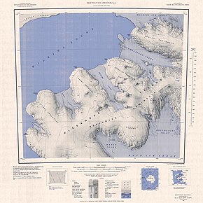
 Topographic map sheet (1: 250,000) with the Harris Peninsula (center) |
||
| Geographical location | ||
|
|
||
| Coordinates | 71 ° 28 '47 " S , 74 ° 9' 9" W | |
| location | Alexander I Island , West Antarctica | |
| Waters 1 | Wilkins Sound | |
| Waters 2 | Verdi inlet | |
| Waters 3 | Brahms Inlet | |
The Harris Peninsula is a broad and snow-covered peninsula on the north coast of the West Antarctic Alexander Island belonging Beethoven Peninsula . It is located between Verdi Inlet to the west and Brahms Inlet to the east. The 590 m high Mount Lee towers in the center of the peninsula.
Aerial photographs of the American Ronne Antarctic Research Expedition (1947-1948) were used in 1960 by the British geographer Derek Searle of the Falkland Islands Dependencies Survey for mapping. The Advisory Committee on Antarctic Names named them after Michael J. Harris of the United States Navy , commanding officer of the VX-6 squadron from May 1982 to May 1983.
Web links
- Harris Peninsula in the Geographic Names Information System of the United States Geological Survey (English)
- Harris Peninsula on geographic.org (English)
