Heroica Cárdenas
| Heroica Cárdenas | ||
|---|---|---|
|
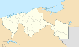
Coordinates: 17 ° 59 ′ N , 93 ° 23 ′ W Heroica Cárdenas on the map of Tabasco
|
||
| Basic data | ||
| Country | Mexico | |
| State | Tabasco | |
| Municipio | Cardenas | |
| Residents | 91,558 (2010) | |
| Detailed data | ||
| surface | 22 km 2 | |
| Population density | 4,162 people / km 2 | |
| height | 20 m | |
| Post Code | 86500 | |
| prefix | 937 | |
| Website | ||
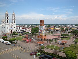
| Heroica Cárdenas - Parque Independencia | ||
Heroica Cárdenas (short Cárdenas ) is a city with about 100,000 inhabitants in the southeast of the Mexican state Tabasco . It is the administrative seat (cabecera) of the Municipio Cárdenas .
location
The town of Heroica Cárdenas is about 2 km from the Río Mezcalapa and about 48 km (driving distance) west of the city of Villahermosa at an altitude of about 20 m . The climate is humid and humid; Rain (approx. 2100 mm / year) falls mainly in the summer months.
population
| year | 2000 | 2005 | 2010 |
| Residents | 78,637 | 79,875 | 91,558 |
In the second half of the 20th century, many new settlers immigrated from other regions of Mexico. Colloquial languages are mainly Nahuatl and Spanish .
economy
The region around Cárdenas is largely agricultural; Corn , sugar cane and beans are grown . Livestock breeding also plays an important role. Despite the relative proximity to the archaeological sites of the Olmecs and the Maya city of Comalcalco , tourism hardly plays a role in the economic life of the municipality.
history
Before the conquista by the Spaniards, the area was only sparsely populated by members of various Indian tribes. There were numerous raids by English pirates in the 17th century . The present city was founded shortly after 1800 by José Eduardo de Cárdenas under the name San Antonio de Los Naranjos ; The settlement received the town charter (villa) only in 1851. It received the addition Heroica because of its resistance to the French intervention in Mexico in the years 1861-1867. However, it only grew to a significant size after a road was built in the 1930s and 1940s and through immigration from other regions of Mexico.
Attractions
- The streets in the center are mostly laid out at right angles; at the central Parque Independencia are the church and town hall.
- The two- tower Iglesia de San Antonio de Padua , a three-aisled building with a transept from the mid-20th century, has a crossing dome raised by an illuminated drum ; in the spandrels of the pendentives there are paintings depicting the four evangelists .
- The small Museo Carlos Pellicer shows exhibits on the city's history.

